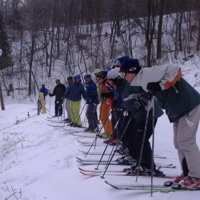
Morning Snowfall weather report
February 5, 2009
126 posts
25 users
83k+ views
Snowshoe Cking in with 4 more inches past 24 hours & further north up in Canaan they got only 2 this go around & heading further north 7Springs gets 4 & Laurel Summit getting 7.6..Yee Haa!
Every area on the western front will get snow all week & into & thru the weekend & Beyond! (& COLD TEMPS) 1 above at SS & 3700' Canaan this morn...Could be up at Stowe,Vt this morn with 10 below (Actual Temp)...BRRRRrrrrr...
Snow..Snow..SNOW!... another 4 at the shoe with about 9 up at Canaan (11 inches if you believe the valley obs dude)..7springs picking up another 7 & the drum roll & band leader being Laurel Summit with another 10 to build their snowcover up to 17 inches...Not to shabby..huh.. Powder spoiled Bushwacker?...How far is Laurel ski area from Laurel summit?
Canaan Valley just passed the 100 inch mark (104.3) for the year...Snowshoe beat Canaan to the punch to the 100 inch marker a while back which has not been the norm for recent years..
Everyone was in the single digits with snow still falling!
Even the lowlands (Liberty/whitetail) got a couple of freshies to go with a big manmade dump...Whitetail is 90% open & expect to be 100% open by the weekend!
and cold.... My thermometer here at the base of Timberline says 7.5 degrees and falling. My very unoffical observation (the west facing, 2nd story deck) says 5". No anemometer up here so I can't give you wind speed

Dolly sods cam (3800') is showing 1 degree & Timberline is reporting a 3.2 degree reading at 1030am..you skiing today..Clay? Tomorrow will be colder!..They had to shut down a few areas up in vermont because of the extreme cold..
HMmmmm..5 inches on upper west facing deck...you ck the lower deck for the other 4?

....It could snow a foot at my camp up there & would only look like 2 inches the way the wind carries it away..
Yeah, measuring snow up here is a b@#%ch!
I found a good calm area in my yard and I set up an elevated snowboard out there and I think I'm getting the most accurate measurements I've ever had (just a longer walk to go measure, which is not fun in this weather)
I had 2.8 inches when I cleared the board off last night before bed. This morning at 8:30 there was another 6.5 on there -- giving me a total of 9.3". Looks like only about another 1/2" or so has fallen, buts it has picked up a bit recently.
I will go look under the deck for the other 4

. I know that that is not the scientific place to measure it, but I'm not going any farther in my slippers!
I hope to get out for at least a couple of runs today if I can get through all of my meetings, but the cold and all of the snowmaking may persuade me otherwise.... Of course, there's always night skiing tonight

BTW, my thermometer now says 8.2
at 1pm Timberline is showing 2.5 degrees & the dollysods cam showing a big ZERO..you must have your thermo in the sun Clay..TGD's therm used to read warmer too..anyway I cked out TL webcam & there are skiers!..I won't go out below 5 & not stay out very long at temps below 10.
The thermometer is in a nice sheltered spot. But the weak link with electronic thermometers is the battery. Once under about 10 degrees, accuracy starts to become suspect because the battery can't keep a constant voltage.
I've been cussed at for challenging a temp reading before...Thanks for not biting my head off!..I will be covering a couple of my most tender palms tonite & tomorrow down here in NORTH carolina..near record lows both nites. I'm thinking of blowing some snow with my presure washer over the plants to insulate them!..happy skiing diehards!!
You're welcome, but there was no reason to bite. Weather is a fickle thing and very, very local. I think people get worked up because they want to believe the highest snow totals and the lowest temperatures. That's fine, but just because I said I only measured 5" on my deck doesn't mean they didn't measure 11" at the top of the hill.
I would rather have a good time having the discussion then having everybody afraid to say anything for fear of being chewed out

U-DA-MAN...but did you brave the temps today & ski?.. I See a little snow has come back into the pic...got to be utah light fluff!...winter is still on for a couple of more weeks...at least..
No, I didn't.
But I plan to give it a try some time tomorrow morning if the wind's not too bad.
GW??...Temps across the Mid Atlantic Highlands (Alpps) range between 8 to 14 below Zero this morn..there has been a 1 to 2 inch snowfall cap to this latest snow round which makes the Alpps the top snow dog in the country for now. There will be more snowfall for this weekend into early next week & temps should rise to more comfortable levels for the weekenders...speaking of temps..how bout 30 to 40 below up in vermont as I write this morn! (These are all Actual temps...not windchill)
Minus 11 degrees here this morning. I've decided to wear pants today.
I've decided to wear pants today.
Those of us visiting the valley thank you for that...
My digital thermometer stops at -4, so all I get now is LL.L. I'm pretty sure that it means 'D--m Cold'
I read -9 on the valley floor this morning w/ slight winds.
It's definetily a beautiful, snowy seen from inside, but outside it is gnarly.
Went outside for a couple minutes...to drag the dog more than 5 feet away from the deck to do her business...when I came back in I had tiny frost nip on my nose...man once you get frost nip a couple times I guess your more likely to get it???
My dog would have nipped me in the nose for dragging her out in that!...14 below reading on the Sods Cam (3800')right now & I think 4800' snowshoe got down to -16. In the 17 years that I have been going to the Valley i think that -14 was my coldest temp experienced. I've seen 22 below while up at Stowe,Vt..thats my coldest but there was 0 wind so maybe the 14 below at the Valley was colder windchill wise?!
Clay, From a distance, at times you can bairly see the slopes through the snowguns(looked like that yesterday to). I don't know if you can see out of that cloud of snow over there, but believe it or not it is a bluebird start today.
It seems that they're now (12PM) focusing on the top of the mountain, so I can now see the sky again
I was out to get some wood earlier and while I had a mask and hat on, it did not seem terrible. The wind hasn't picked up yet and everything was very, very still.
It's getting warmer - my digital thermometer is working again - 0.9 degrees right now...
The Dolly Sods webcam is still showing -13 below at 11:45! Wowsers... not getting too warm today is it.
i skied thursday (great conditions by the way); when i rolled into the timberline parking lot, i realized i forgot my jacket. so just layered up and was fine. but today?, forget about it.
I just noticed that the temp that I have been giving for Timberline is actually a PWS..a home sitting at 3575' up at Timberline...at 5 pm they are reporting 3.6 below while a little over 200 feet higher & a little north up at Canaan Hgts the Sods Cam is reading -5..seems to gel.Also there is another gov't weather station in the valley reporting a 2.6 below reading. Timberline resort proper is reporting 3 above which I would guess is too high...FYI to all you all that don't have a life!
Yeah, my high here in Davis today was 0.9 degrees. Its -3 right now. I was disappointed as I was hoping for an entire day below zero. I'm sure the higher elevations stayed a few degrees below zero all day -- but we may beat them tonight if the wind dies down.
Just to add another data point, the personal weather station at Silver Creek read a high of -2 and a low of -14 today. It may well drop below -14 before midnight so that might change.
Yeh Murphy..when I 1st gave this morn report I was using the Silvercreek sta & the Dolly sods Cam as ref for the -14...a little later I noticed Snowshoe resort posting a -16.
This has been the coldest day in the 9 years I've lived at the Beach in SE NC..it hit 32 for the high!..back in 1950 when they must have been experiencing GW.. it hit 80..
You seem to have an Accurate thermo Jonjon..Appreciate all your info & your new Snow board!...talkin east coast, you have to head up to Stowe & Jay to see more snowfall than the valley/Snowshoe so far this year...course being south of the mason dixon we get more melt...luv that Southern exposure!
I think that tonight the lowest temps will be in the high valleys as opposed to the high ridges. For example, right now I'm at -8 while Canaan Heights is at -9. The winds have started to calm down, so, if that continues, then we will see great cold air drainage. I suspect that the lows here in Davis and Canaan will be lower than those of Snowshoe and Canaan Heights. I'll guess we'll see in the morning.
I have two digital wireless thermometers at my condo. One showed -16.5 F and the other showed -17 F at Summit Condos at 0630. Basically both reading at -27 C. At 1530, one showed -2 (-19 C) and the other one showed 6 degrees (-14 C), since that one is on the Western facing deck and the deck was heated by the sun. We had two frozen units last night - the owners left the thermostats set two low...
Discretion being the better part of valor, I didn't ski today. Fixed a mean beef barley stew from scratch for my guests coming in tonight...
Right now at 2153 hours both units are showing -10 F (-23 C).
All my faucets are left dripping and the sink cabinet doors are open...
I feel like I'm back in college in Vermont...
Jonjon was right..this morn the temps at the higher elevations were in the 7 to 10 below range & actually hit the lowest point earlier in the morn..signs of a little warmup for all you weekend skiers...the bottom fell out of the "bottom areas"..17 below is the lowest I can find so far at Elkins,wv..1 degree below the record!..Scherr at the bottom of the western front range got down to -15 & Harman & Parsons got down to 13 below. I'm sure there are some lower readings out there..somewhere!
Bet the 16/17 below 0 was the coldest temps that you have experienced up at the top of SS so far Ibotta..was it?
The Coldest Temp recorded since 1945 (When oficial temps started) for Canaan Valley was 27 below on Jan 21 1985...
I'm sure there are some lower readings out there..somewhere
Sure was...Glady WV...25 cold friggin degrees below 0!!
Even better Andy -- my thermometer now reads -26 degrees. Not sure if that was the low or not, I'll have to check my computer at the main house later to verify. Cold air draining was king this morning. It would be interesting to know Canaan's low.
Actually, wifey just called me from next door and confirmed that our "official" low was -26.3 degrees. My personal experience low.
I read -18 on the valley floor right before sunrise, but that might be the bottom of my digital thermometer...I don't know..I know that the sun is decieving, and it is a lot colder than it looks!!!
The obs guy for Canaan (Floor) has a minus 19 at 7am this morn so tucker has a good reading...I'm Amazed!..-26!!...That has got to be as cold as it gets up there!..I have records for the Valley but just have scetchy reports for Davis & Thomas...does anyone know the coldest reported temp in Davis?..You all are living thru Weather history!
If you look at the big pic...a global map, you will see how far south that cold has to travel to get to the Valley area. Its about 2 above in Barrow,AK right now & the closest reporting station to the north pole is reporting about -35...-26??!!...Impressive!..I heard you all got Al Gore strapped to a telephone pole butt naked in Davis & folks are smacking him with Icicles
Elkins tied a record low at -18. I'm surprised the valley was not colder.
Heck, even Parsons made it down to -18.
Here in Trent, PA (6 miles E of 7Springs) my thermometer read -13.2 at 8:00 AM today. That's the coldest we've had so far in the 3+ years we've had the property up here.
Glad I skied Tline yesterday when it was still warm.
Glad I skied Tline yesterday when it was still warm.


jonjon set a personal record for cold, that's impressive.
My son's school sent a group to Mont Tremblant this weekend. He decided a while back not to go with them. I think they'll be seeing the brunt of this Alberta clipper all weekend.
The obs guy for Canaan (Floor) has a minus 19 at 7am this morn so tucker has a good reading...I'm Amazed!..-26!!...That has got to be as cold as it gets up there!..I have records for the Valley but just have scetchy reports for Davis & Thomas...does anyone know the coldest reported temp in Davis?..You all are living thru Weather history!
If you look at the big pic...a global map, you will see how far south that cold has to travel to get to the Valley area. Its about 2 above in Barrow,AK right now & the closest reporting station to the north pole is reporting about -35...-26??!!...Impressive!..I heard you all got Al Gore strapped to a telephone pole butt naked in Davis & folks are smacking him with Icicles
I was in touch with Dave Lesher this morning. Not much records for Davis and Thomas proper so this is as low as can be confirmed, and only one degree short of the record for Canaan Valley.
Feel like you just caught a record fish?...did you actually walk outside during the record cold or did you just read the temp from inside??..this is for history..did ya??..walk outside?...
PS..Notice the wind shift to the south & the clouds moving in?...New Snow a-comin!
Hell yes I walked outside. But only for a minute. Cold air hit my lungs and made me cough until I got used to it.
The West Virginia Record is -37 but I'm not sure where it was recorded. The data's probably somewhere in here:
WV Climate Data The lowest record for Canaan in this data set is -27 but it only spans 30 years. It doesn't include Davis for some reason.
Edited to add: I found the location of the WV Record. It occurred in Lewisburg, 12/30/1984.
http://www.natice.noaa.gov/pub/ims_gif/DATA/cursnow_usa.gifWe are losing the lake effect machine (Lake Erie almost frozen over) ...this time last year there was 0 ice on the lakes.Even though the LE is losing its punch, weather/snow chances stay interesting with different type weather systems from now on..
Mini clippers roll thru later on tonite & thru the week ahead...pacific moisture caught up in the east coast trough that tries to hang tough...1 to 2 inches each event..
NC Mtn's getting some of the light snow action + they know how to blow snow!...Cking them out next weekend..(sugar)
PS..I'm talkin western front Alpps only...
Dusting in SCranton last night showing 13 on the car thermometet.
Hoping the cold keeps the crowd down. 13 will do that. May start the day with handwarmers in.
Dusting to half inch south of Mason,dixon...CK out the pics of Laurel mtn by Camp...the SW PA areas have been getting some goodies!...the southern Alpps will be getting into the action later on today/nite..place like Beech mtn,nc could get up to 10 inches during the next few days..SS/Canaan should do allright.
Seven Springs along with all the natural that they have been getting claim to have blown 2 feet in the last few days as well!
Heh Wojo..I've never used Hand or boot warmers but I think I'll ck em out in the future...cold seems to be getting colder as I get older...
picked up about 3" here so far (overnight and this morning). It's still snowing, light to moderate I'd call it. The radar on wjactv.com is showing ice in southern Fayetts county (next county west of Somerset). I hope it stays there and doesn't sneak north.
A few inches of love has fallen from the sky today. It was wet and not much wind with it which is unusual. We also must have had some freezing drizzle overnight as there is a nice crunch layer on top of the old snow.
Snowing lightly now with temps dropping and wind picking up.
Yeh..you've had your "Pretty snow"..Now the wind is switching around to your normal w/nw upslope. It will go back & forth with each clipper type wave swinging around that east coast trough we got going.
TL cam is down but Canaan's cam is working & it looks like its busy there!
Back to football...GO CARDINALS!!
& the beat goes on!..Upper teens & 4 to 6 inches of new natural from SS on up to the "Knob"...Laurel Summit getting another Half foot...That ski area needs to be open!...more snow till further notice
...Beech & sugar,NC got a few also & there is mention of Snow tomorrow all the way down here at the Beach in SE NC..Unbelievable!
Hey, Andy. We had "Colorado" conditions all weekend in the valley. It was snowing like a big dog when I left at 4 pm yesterday. I should be very fine all week. Can't wait to get back this Friday.
Dave on Canaan Heights reporting over 10" for the weekend. I measured over 9 here in town.
What is there to get so excited about?..Bushwack says it snows 6 inches every day in march up in utah

....3 to 6 each day for us just don't cut it


over 2 feet in just over a week up at Canaan hgts & 47 inches for the month so far!...not quite done yet..little break later on this week..some mishmash leading back to more snow this weekend..
you didnt see the one pic TR did you?
last weekend was good.
I am excited to ski it but its a joke that people freak out about it is more the tone of that post.
What is there to get so excited about?..Bushwack says it snows 6 inches every day in march up in utah
....3 to 6 each day for us just don't cut it
over 2 feet in just over a week up at Canaan hgts & 47 inches for the month so far!...not quite done yet..little break later on this week..some mishmash leading back to more snow this weekend..
No need to get excited? This is the mid atlantic not the Wasatch
. 3 to 6/day is a big deal for the WV Alpps, especiually if it contuinues for a week.
Just messin with ya Wackman..we like to get a little Glory from our little/big mountains that can turn on the Snow machine here & there...been enjoying your hard core posts!
The Folks down here at the Beach Are celebrating & are in a very festive spirit on this memoriable day...Its Snowing!!...Palm trees are looking frosty
....Schools & buisnesses are all closed & not an unmelted flake on any road..Rookie Southerners & Happy dumfounded Yankee transplants playing hookie!
I am surprised and pleasantly pleased how hard Timberline is blowing snow. They have closed several trails to allow them to really get them covered. This should establish a strong base for a long time.
I am surprised and pleasantly pleased how hard Timberline is blowing snow. They have closed several trails to allow them to really get them covered. This should establish a strong base for a long time.
From what I've heard, they might need it to get through early February.
Thursday was cold (and very deep). Friday was a bit colder (still pretty deep). Saturday was down right cold (somewhat deep). Sunday was warm (15 degrees & locally deep). Monday was fairly warm (20's & kinda deep again). Today was cold again (9 degrees & found a few stashes in the trees). Awesome 6 days of skiing. Will report down the road. Must attend to "neglected duties" 1st....
I am surprised and pleasantly pleased how hard Timberline is blowing snow. They have closed several trails to allow them to really get them covered. This should establish a strong base for a long time.
Hey Clay are you livin down there or wut? You are right tho they are pulling out all the stops. Tree skiing...... open for business- checked double checked. Like to ski big wide groomers covered with packed powdr???.... plenty of those. Whales and bumps and freshies daily for the past week and how about them liftlines???? If you are tired of standing in line instead of skiing get uself to timberline, only long lines this five day

weekend was at 5 oclock in the bar and in the rental shop i've been told. If you've been thinking about a trip to Tline, better not put it off cause it does not get much better than this. That's all for now
, j.
Still snowing -- several more inches yesterday and last night.
What's goin on over there anyway! 15 inches of snow in the last three days... lets just hope it doesn't get too warm/rain on Friday!
few more last 24...few more this weekend..few more next week..
Even without the liftlines at TL though Jimmi, its still hard to get into a rhythm..a steady good workout session.. because once your half back up the mountain your cooled back down & then going into hybernation by the time your at the top!..I keep trying to hitch a ride with the workers on snowmobiles when I'm up there..Got a free ride down once..but thats another story..
I am surprised and pleasantly pleased how hard Timberline is blowing snow. They have closed several trails to allow them to really get them covered. This should establish a strong base for a long time.
From what I've heard, they might need it to get through early February.
Heads up Murph - looks like MM may have hacked your account
Repeat after me:
I shall not think bad thoughts...I shall not think bad thoughts...I shall not think bad thoughts...I shall not think bad thoughts...I shall not think bad thoughts...I shall not think bad thoughts...I shall not think bad thoughts...I shall not think bad thoughts...I shall not think bad thoughts...I shall not think bad thoughts...
Feel better?
[url=Ihttp://www.visitcanaan.com/]Ihttp://www.visitcanaan.com/[/url] was thinking the same thing Tom!..
"STOWE" West Va?...http://visitcanaan.com/
maybe this will work
Heads up Murph - looks like MM may have hacked your account
Repeat after me:
I shall not think bad thoughts...I shall not think bad thoughts...I shall not think bad thoughts...I shall not think bad thoughts...I shall not think bad thoughts...I shall not think bad thoughts...I shall not think bad thoughts...I shall not think bad thoughts...I shall not think bad thoughts...I shall not think bad thoughts...
Feel better?
I know, I feel sick just reading what I wrote.
Here's something more positive: the end of the week warm up only looks to warm the mountains into the 30's and then it's cold and snowy for the rest of the 7-day forecast.
Now you're drinkin' the kool-aid. Sip sip sip... One weekend at a time. Should be another good one coming up.
Tom
Gee, I was going to head back up to the valley Thursday nite, but with all the pow-pow maybe tonite will be the do if I can convince the Mrs.
Another Cold Morn up at Canaan valley with another 2 inches falling yesterday..Wisp picked up 1 & just a trace at SS..
This week will be interesting with about 3 weather events, starting with one this aft/nite...mostly all Snow with a little mishmash working in late tue/wed morn & then back to snow & then finishing out the week with more snow into next weekend. Could get a foot or more before the weeks out with the WV Alpps getting the most...Stay Tuned..things are evolving!
Conditions would be friggin Awesome With a MPC or Tory up & running... add them to SS/Canaan areas on up to SWPA & I'd never Butt into another "Utah" thread again Cuzzz I'd be in Alpp "Almost heaven" paradise
!!!
Andy, this past weekend was
interestingweatherwise in the valley. First was Friday which was the most incredible spring skiing in several years.
Downright AWESOME! Guess it was due to the nearly 30" they had over the previous 8 days. Then it came blasting out of the North. A frigid blast which froze everything in it's place instantly. Boiler-plate everywhere... on the slopes, on the decks, in the parking lots. Saturday was cold, windy, and had dropping temps through the night. Skiing was, in a word, FAST. Sunday was tranquil. Sunny, and bright. Near zero in the AM but warmed up to the mid 20's by the afternoon. Can't wait to see what Ma Nature brings this week.
Yeh..& it looks to be interesting all this week also Kwill!..Looks like another soft inch over night in the west va areas..none north..
There is potential for the worst kind of driving conditions coming up with the FZrain/Sleet kind of stuff tomorrow so be carefull folks & watch the road & weather conditions for your travels. Lots of Snow to go with the mishmash so...have fun!
so anyone thinking about skiing on thursday anywhere?
I have feeling my Thugs can come and out burly around lesser skis again this week. The stares you get locally are worth bring them out in 6 inches of snow.
Thur should be good skiing...
Another 2.2 inches falling overnight for the Alpps (Canaan) & a couple up at the Springs... Should see a Nice little dump till the mishmash works in with the warmer surge of air later on today/eve...& then back to all snow by midday wed & on into the weekend...
Al Gore in DC for GW stuff...Its snowing in DC...Al Gore Law..snow & cold follow all the GW summits
Def. more than ~2 inches today. Maybe it was because I was blasting first tracks for a good while...
What's the latest update from Canaan Valley?
Had about two inches of snow up at Massanutten today... then changed over to sleet around 2 then freezing rain by 4, nasty!
The latest on my deck @ TL is about 4-5 [remember - west facing deck, 2nd floor, bunkhouse view unofficial observation only - your mileage may vary] which is about what I saw this afternoon on the slopes. I think it has turned to freezing rain, but so far, it hasn't had a big impact on the snow except to take the 'fluff' off the top.
Not to much wind today was there?..West facing Deck prob is right on the money... From what I can see from my Amma-pro weather desk( :DI )ts about 27 to 28 up at Canaan & I noticed that Snowshoe went up to 33 earlier today but has gone back down to the upper 20's.Freezing rain is kind of a blessing because it will seal the snow if the real rain starts later on...& then back to snow tomorrow!
No, not much wind. There was a bit at the top of the mountain, but it was pretty calm all day at the base. The deck thermometer has it at 30.0 at 2200.
That PWS at 3550' up in TL jumped up to nearly your 30 degree mark in just the last half hour...warm wedge is here...later than f-casted which is good!..Any reports from DC?..How was the drive home Abe & anyone else..watch the drive to the slopes tomorrow!
I left at 2. I think it ended up being a pretty good idea. I hated to leave the sweet conditions in the Valley, but my "Real Job" requires me for a few days and I just walked outside a couple minutes ago and could literally ice skate on the side roads here in town.
Still not too icy here. Knock, knock. Just got back from a hockey game at Reston (7-10 miles outside the Beltway.) Roads were a bit tricky, but not bad if you took it slow. Heard it was very icy further west in Gainesville.
Maybe 2-3 inches of snow fell in Margaritaville before the mix started.
We got around 2-3" here in the Hardy Co. area with lots of sleet first, then a mix of that and freezing rain on top. Now if only we had a foot and I'd be hiking some local hills.
Our typical winter weather here in south of the Mason-Dixon line, Mid-Atlantic ski county....ice, rain and snow all at the same time.
The last time we had a big coastal storm dump in the Appalachians was January 2003.
Never the less, I think we're having a pretty good year. Hopefully the February thaw won't last too long or better yet, we won't have one.
Any reports from Timberline or the rest of the valley? How much ice and how much rain?
The deck is not equipped to measure ice and rain, but sadly, there is no longer any snow on it this morning. My thermometer shows 48.0 degress at 0925.
Wow 48 degrees! We are only at 31 over in Harrisonburg this morning...
Hot air rises..cold air drops...Everything will be back to winter by this aft in the high country..
The last time we had a big coastal storm dump in the Appalachians was January 2003.
Keep your fingers X'ed for Mon/Tue next week...word!
Your Hockey team ever win JohnL?...You never post results...Playing hockey must be great for your skiing..Great strenth conditoning.....I might need a dust off of my statue soon!
Hot air rises..cold air drops...
It's a good thing the Internet has a roof, or sometimes I think this board would float away
I might need a dust off of my statue soon!
Andy, I took care of it on my way out of the Valley yesterday afternoon. On Thursday evening I will stop by on my way back in and use an ice pick to remove the 6 inches of ice that has accumulated over the past few days.
Still not too icy here. Knock, knock. Just got back from a hockey game at Reston (7-10 miles outside the Beltway.) Roads were a bit tricky, but not bad if you took it slow. Heard it was very icy further west in Gainesville.
Maybe 2-3 inches of snow fell in Margaritaville before the mix started.
JohnL,
I was at the Reston Hockey Rink late yesterday afternoon myself. But I was there to go Mtn. Biking.
Got to get fresh tracks some how.
Why do all these storms take a track to the west/north of our area!!!! That is why we keep getting rain out of these storms. Despite the cold area that has been around. The traditional track of these storms is usually to the south, they move off of coastal Carolina and then move up the coast. It seems like there is something blocking that track. Can someone tell what type of weather condition is causing these storms to move up the Ohio Valley?
Canaan Hgts started the switch back to snow at 1 pm... Bush caused it in answer to your ? & now that Obama is in.the storms will be right back on track! .. .We are due Snowsmith..stay tuned!...
Bush caused it in answer to your ? & now that Obama is in.the storms will be right back on track!
You are truly the wise one, Fishnski...why didn't I think of that. He even f'd up the skiing!

There is some sort of frontal Squall line going Canaan & up & down the western front causing what looks like HEAVY SNOW...looked that way on the canaan ski cam & Elkins was reporting Heavy rain with a temp just above FZ...You still up there Clay?..Jonjon?
Thought you might have liked that SS!
You nailed it. A big squall came through with heavy thick flakes and the wind picked up quite a bit. Not doing much precip wise right now (1700) but the wind is still up a bit.
Sad to say, it looks like it might be over. Radar shows everything has moved east and the Winter Storm Warning says the heaviest snow has passed
Clay,
Home much damage did the recent rain do to the base in the trees?
The Magic of Canaan should squeeze out some more & then next up is late thur & into sat morn & by then when its all added up we should have that foot or so I mentioned on Sun morn for the week.Pretty much going as scheduled.
like I mentioned in response to Snowsmith at 10 am this morn & just breaking on Accuweather at 314pm..there is that Noreaster word coming up again for mon aft thru wed morn...stay tuned!
I can't keep giving all these heads up for free..Been beating NWS to the punch by a few days each F-cast all winter long..... Fishnski's Amma-Pro weather Svc...still looking for my 1st Cust!...(Special forecasting for...The Alpps!)...
Comon...Clay.. all you front line grunts...Hype the svc up!...You all could get some nuggets for your on the scene reporting..Sighhhh...Never mind..My work doesn't pay me no mind either when I try to get xtra mullah for being the "Chief Meteorologist" at my Air freight Co......Fish Guide Svc..yeh thats the ticket!...I'll be Rich
!!!...need to get another beer...
John,
I haven't been out yet to look, but I will give you an update when I come in from the slopes tomorrow morning.
Based on the weather radar it looks like all of the snow has moved on to New England. We Mid-Atlanticers got screwed again with this storm. Hopefully, we'll get some lake effect backlash snow tomorrow.
Comon...Clay.. all you front line grunts...Hype the svc up!...You all could get some nuggets for your on the scene reporting..Sighhhh...
Andy, you should be one of those front line grunts!! You gotta get away from that dang saltwater and come up to where the freshwater falls from the sky as soft white powder. You Mudda!!

Believe me David...I'm trying to figure out how to get up there soon...My house up there got gobbled up in rentals...I couldn't believe it..in this economy??. I got a friend I can stay with in Davis But he won't let my new pup in the house..I'm watching the weather as usual & would love to play hookie & head up if this storm could whip up next week... NC Mtns are always another option but I'm only trully happy up at Canaan..losing money at work will sting but money ain't everything!....I wear the Ski pants in the family so Betterhalfski shouldn't be an issue...shhhh...Here she comes....
So, can I get a weekend weather report?? When are we going to get some snow? Is it going to be raining in the highlands on Monday??
another 2 inches on the backside of the storm yesterday from SS on up to the springs....& I'm thinking that it looks pretty good right now for snow later on monday thru to the wrapup on wed...could be a doozy Davey boy!...stay tuned!
the wrapup on wed...could be a doozy Davey boy!...stay tuned!
I'm heading for the hills around 5 or 6 this evening, so I need a full report by then!
You & the regulars are getting spoiled with all these good condition windows...good winter so far!..
Your pulling in just in time for the last system of the week David..skiing & teaching in another couple of inches of freshies tomorrow/eary sat morn. Sat will have a breezy WSW wind which is not a bad direction for the north facing slopes up there & then Sun will feel like summer for you & looks to be an awesome day!.....This is all work & no Glory...Weather watching is real easy nowadays.. it just takes time & when this economy kicks back in & I'm rolling at my day job I'm retiring from this job!
...I've allready alerted my work that I am on Noreaster watch for mon/wed & they know what that means!
hmm.... so where is this big storm going to track early next week?!?
I've already started doing my snow dance hoping it will influence the storm to track far enough east to bless the highlands (and maybe even lowly 'ol VA) with a fresh dump!
Rather than hijack the weather thread with a slope report, I started a new thread on Timberline Conditions
here
Accuweather has three tracks they are looking at--sort of an I-75 and I-79 track, and I-81 track and a I-95 track.
We want 95...we will gladly take 81..Because we sure don't want 79....
The models currently suggest 4-6" for Snowshoe between now and Saturday. The Monday-Tuesday event is not fully resolved yet, but it could be off the charts, like 1-2 feet for parts of the Appalachians. I am not kidding. Key word is could. We'll know more in a couple days, but I *will* be bringing my fat skis to Snowshoe when we drive up Sunday.... After bringing skinny skis to Utah last week, it would be ironic if I could bust out the fatties at Snowshoe, but I like irony. A lot. BRING IT ON!
Your right 219..looks like this preliminary bout before the main event has a little more punch than advertised....Things still look to be on Track for a good snow for the high country & hopefully the Lower & more eastery ski areas will get into the action once some colder air fiters down to them...Keep seeing the rain word for mon in f-casts for even the WV Alpps but I'm thinking (& my thinking could be stinkin) that if any, the rain would be short lived & will quickly turn over....This thing actually might not wrap up till thur for the Western high areas...could get just as much wrap around as the main event...you all have seen that before!..Cold stuff getting sucked into this system tooo...wrap it up!
MOnday morning rain is whats freakin' me out so far...
Some models are saying no rain, some are saying rain to snow in the afternoon.... everyone is saying that Monday is going to start out warm like Sunday, then get cold and snowing. The question is when the precip hits - just ahead of, or just behind, the colder temps.
Tuesday is looking like a good day for freshies, but the snow has turned back into our usual mid-atlantic huge flaked high humidity snow, earlier this season we were blessed w/ so much light fluffy crystal pow that Im almost spoiled on it. Wonder what we'll see next week...?
Crossing fingers for a good Monday.
You have to careful of what you wish for...if its fluffy powder you want for the whole storm then you are wishing the storm track to be further east which would give the Alpps (western front areas) Powder but less of a dump or base buildup.. I'd like to see the storm right on top of us just to the right side to give us the heaviest moisture laden Dump of our life & then Remember that we have wrap around moisture that will be the light/cold & fluffy (but windy cold) to cover our tracks with! We don't want it to track so far out to sea that OC ,md gets snow & the western mountains get flurries....Not everyone can be happy with this storm..lets just be happy that we get one....1 step at a time!
What I feel is amazing (& I hope I still feel this way tue) & I think we take for granted is the fact that we cannot even Identify this storm on Radar yet...it has not been born yet!..The models picked this up a ways back...I didn't alert anybody to the Chance till there were a few model runs & the storm kept popping up & that was a few days ago...think about it & if this storm is born & drops some goodies then I feel we have come a hell of a long way in the weather world.....Now on the other hand.....we won't go there!
Models trending east with storm (do we believe that?)...But there is another piece to the puzzle with a feature forming in the ohio Valley which will take care of the WV Alpps either way not to mention the backside of the coastal which will be enough to lure me off the beach & head for the hills! I'm done trying to figure this thing out & will watch it live while I enjoy many runs down a (Hopefully) Snowy mtn up in the magical land of Canaan....& hopefully We will make it off the Mountain Wed Morn....Hellbenders in Davis tomorrow night?
More info on Hellbenders please.
Thanks,
The Colonel
Rather than hijack the weather thread with a slope report, I started a new thread on Timberline Conditions
here thank you Clay
fishnski,
perhaps you could start a dinner thread
Not trying to be rude, but the folder headings are not very pertinent for the short time I've been here.
An occasional TJack(short lived)is expected. But some are so conversational, almost think a tele/PM/email would work better for those.
Again, apologies for the lack of tack
Also, wasn't sure which folder to stick this TJack in.
See what you started Colonel
...Anyway Mr. Me sorry for the side notes but some of us have been posting here forever & are very familiar with each other & we tend to go off subject sometimes but try to bring it back on track (Like this Storm)asap...Anyway, I started this thread so ..I'm the boss
.
Anyway to get back in line it looks like a little minor upslope snow this eve & into early Sat for the Highlands (Which I started calling the Alpps years ago) & then we all wait with Baited breath for the main event Mon/tue..& into thur for the Western front highlands AKA..Alpps...Stay tuned!
There is no Mr Me, just ME. I was just taking liberties, I sensed the offenders posters might find the lite side.
I do enjoy everyone pontificating on the various weather models, must be propriortory. Many moons ago I use to chase it for other activities, and try to educate myself, but made my head hurt and started to consume way too much time, almost a way of life. But you all know that.
Do have an interest in DIY weather stations,software, etc. if you care to share any such stuff to save from wasting my time researching until it becomes outmoded. Or point me in the right direction anyway. Not trying to elicit trade secrets, just an interest.
Perhaps another folder for sharing such stuff.
Thanks for understanding and continue to look forward to your next reports/discussions
MichaelME
So far the NAM seems the most reasonable. GFS is out to lunch, showing the storm moving out to sea (NWS seems to use GFS, hence the rain we keep seeing pop in and out of Monday's forecast -- don't worry about it yet). It's not uncommon for the models to keep flipping around. Sunday's actual weather observations will tell us what we need to know. It's not forecasting at that point though!
Monday night will bring the big snows if the storm really goes off as we'd hope. Tuesday will be the day to ski fresh snow. Monday is still a ???, might just be the day to get "into position" for primo Tuesday skiing.
Models trending east with storm (do we believe that?)...But there is another piece to the puzzle with a feature forming in the ohio Valley which will take care of the WV Alpps either way not to mention the backside of the coastal which will be enough to lure me off the beach & head for the hills! I'm done trying to figure this thing out & will watch it live while I enjoy many runs down a (Hopefully) Snowy mtn up in the magical land of Canaan....& hopefully We will make it off the Mountain Wed Morn....Hellbenders in Davis tomorrow night?
Well..we didn't get the 18 inches in 2 days from the Coastal but adding the 4.7 Canaan recieved in the last 24 hrs it all adds up to 12 to 14 inches in the last 3 days for SS/Canaan...front side, back side..WV Alpps get it from all sides