New Germany and the Whiskey Hollow Ski Trail
April 26, 2010
I found this while doing some internet research for Midway Cabin in old Pittsburgh newspapers. I consistently found ski reports for a ski area called New Germany in Maryland. With very little trouble I found this interesting history complete with old photos of the ski runs built at New Germany State Park in Garrett County:
Skiing Comes to the Maryland Alps
PATC ARCHIVES See pp 42 of the April 1940 PATC Bulletin (bottom of page)
This has a good discussion of the New Germany Area and also talks about a new area not listed in the DC SKI lost areas. This is Sexton Knoll in Shenandoah National Park. Based on some old topos I think Sexton Knoll is the Pinnacles Picnic Area. GGNagy---you are a good topo guy. could you confirm? Based on the article, not only was the area skied, but was intentionally cleared by the NPS for skiing.
Keith,
Just from a preliminary glance at the article and some maps, I think that the ski area was actually on the east side of Skyline Drive. Dropping off to the west, it would be a thousand feet before "runout". If the slope was really dropping that far, I think we would see a mention of it in the article. We later see that skiing Skyland Rd does indeed drop 1000ft. There is a northeastern exposure on the east face of the ridge that has about 300 feet of elevation drop with runout.
Jewell Hollow would make a nice 1500' ski area now.

Thanks, GG. I was wondering how such an important ski area would go unmentioned on this site. I wonder if the area was commonly known as New Germany or Savage River. It was always listed as New Germany in the Post-Gazette ski reports.
Edit to add: After reading the link Kieth provided it confirms that the ski area was known as New Germany. That makes sense from a marketing point a view.
Also, what was true about glade skiing in 1940 is still true today.
Guess I wasn't the 1st person to call our highlands "The Alps"..although Maybe I'm the 1st to spell it "Alpps"..
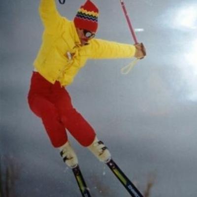
Very interesting article..Ck out the Long sticks..& the great form!
Pretty wild that the forester in charge of cutting the downhill expert trail was advised to read a Boy Scout Ski Merit Badge Handbook because it was one of the few published documents in 1941 describing the skill of skiing and what real ski trails were like.
From the description of the trail it sounds like it would be a challenge even on modern equipment, pitches up 35 degrees and a 800 foot vertical drop. It sounds like fun.
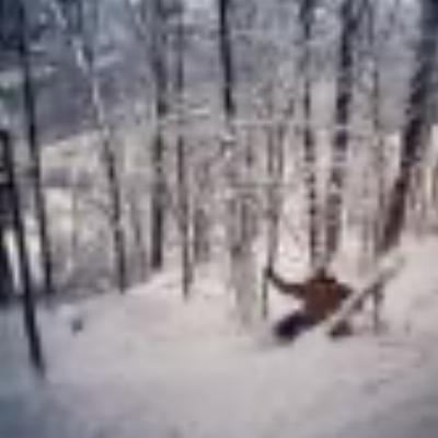
I have to go and find where I put the few pictures I took of the area that should be the finish of the Whiskey Hollow course. It was very grown in and very steep. I wish I could get access to the top, as it looks like there might be more clues to the trail up there, but that area is behind the gun range. Somewhere I would rather not go exploring.
Oh yeah. If you go looking for the other slope based on the name being "Otto Farm", make note that the Otto family was one of the biggest in the area.
We need those "experts" on CCC trails from NELSAP, Mapnut and Rocket21 to come down and find the trails.