Snow watch for West Virginia Alpps 11-5-10
November 8, 2010
35 posts
14 users
10k+ views
IN THE FORM OF RW/SW
ACROSS THE LOWLANDS AND SW FOR THE MTNS. POPS WERE KEPT IN THE LOW
SIDE OF CHC...AGAIN TO MAINTAIN SOME SORT OF CONSISTENCY.
HOWEVER...SHOULD THE MODELS STABILIZE AND CONVERGE TOWARD A SOLUTION
CLOSER TO THE GEM OR ECWMF...THE AREA COULD BE LOOKING AT A
SIGNIFICANT SYSTEM FOR THE END OF THE WEEK. A STRONGER SYS WOULD
ALSO BRING THE REAL WORRY OF ACCUMULATING SNOWS IN THE MTNS BEHIND
THE SYS. STAY TUNED....Its just a watch so don't freak & anyway, You Heard the Dude....Stay tuned!!
LOTS OF UNCERTAINTY IN THE MODELS WITH THE EAST COAST SYSTEM
WEDNESDAY THROUGH SATURDAY. STARTED ON WEDNESDAY NIGHT WITH A BLEND
OF THE ECMWF AND UKMET. FOR THURSDAY ON...SHIFTED TO A ECMWF AND
ECMWF ENSEMBLE MEAN WITH A ADJUSTMENT TOWARD THE CANADIAN ENSEMBLE
MEAN TO PRESERVE SOME DETAIL. THIS BRINGS A SYSTEM UP FROM THE SOUTH
EFFECTING THE REGION STARTING LATE WEDNESDAY. AS THE SYSTEM MOVES
OFF TO THE NORTHEAST...THE REGION GETS INTO THE BACKLASH. FOR MOST
OF THE REGION IT APPEARS THAT IT WILL JUST BE A COLD RAIN...ALTHOUGH
SOME HIGHER ELEVATIONS OF THE MOUNTAINS COULD SEE SOME SNOW. HIGH
PRESSURE FINALLY BUILDS IN ON SATURDAY AND PROVIDES DRY WEATHER FOR
SUNDAY.
I'm just posting NWS info which seems to be Chillin on the f-cast which at 1st post did have a slim chance at a Perfect storm Scenerio but I am not giving up on at least a few inches out of the system...The storm is not important of course..Just a novelty so stay tuned & Enjoy!
The system they were referring to would be 70% rain but then usher in some solid cold and the possibility for 3-6 inches
The reason I posted this snow watch was the possibility for the remaints of Hurricane tomas mixing with a low pressure system in the Sw swinging around & moving up the coast all colliding & phasing with a Deep cold shot coming from the Northland....THE PERFECT STORM...
Well not quite happening but there are still enough factors coming together to have the models say anything from 2 to 10 inces will fall on the High country.. so lets add the two extremes & divide by 2 to get a half foot??....stay tuned you Snow hungry norskies!
I hope you're right. I'm about ready to see some white stuff flying!
so.. you're saying this would be a bad weekend to plan to hike in Greenland Gap?

so.. you're saying this would be a bad weekend to plan to hike in Greenland Gap?
Actually, it'll be a great weekend for a hike. Dress warm, wear warm/waterproof boots & take a pair of trekking poles. It'll be a great time!
84 hr Nam Snowfall If the NAM is right, yes.
But the road over to Greenland Gap will be great.
Greenland gap is on the "Less Snowy" side of the Alpps But I think I got comprex's Snow drift

Just got home to my AMAPRO Weather center (after 15 years of flawless f-casting you would think I would have my 1st Customer) & after CKING out this mornings weather Run I am going to up my Ante to 6 to 8(Thur eve-Sat eve) & would go higher but with a warm ground & the still warm Great Lakes we won't have any Fluff factor...
Shrinkage factor yes...especially if out "hiking" on Greenland gap during the storm & you have to find a tree....
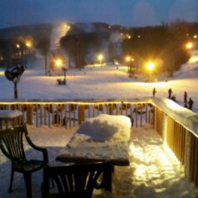
Snowshoe's Facebook is reporting that the rain turned to snow early this morning. I'll try to link some pics when they get them up.
** The DS Webcam looks sweet. Big flakes at 9:45!!
Yep, big flakes started coming down in Davis around 9am with temps hovering in the mid 30s. Canaan Heights is snow covered.
Hopefully we get enough here at T-Line for me to set up a jib in the back yard.
Backyard jibs are always the most fun. During the second big storm last year me an a buddy went to Upton Hill park in Arlington and got some mini pow lines and ollie opportunities. The night before a few of guys had set up in the skatepark bowl next to Upton hill and were trying to get some rock n' rolls and stuff going. I managed to dig a fun little hit near my place but didn't leave enough room for run out so I ate it a few times overshooting the landing.
The last of the "pretty" Snow is on its way out with the main storm & you WV Vets know whats next...Yeh, urrr right...Sideways snow!!...the Blast is coming..
Yeah, I'd reather be making turns but the first tree jib is in place. Just need to shovel a little more to solid it up.
I'm guessing the Valley will pick up 8-12 with many locations 2500 ft+ seeing over 6. New WRF (model) looks very nice. Also, once temps drop below freezing tonight they should remain there through sunday or monday.
Might be a bit too humid to make snow tonight or early tomorrow but should be plenty cold friday evening through midday sunday. Any resort that has the intention of shooting for a thanksgiving opening really should be blowing. If snowshoe really did take full advantage of the cold temps earlier this week (not just a few publicity snowblowing shots)and goes hard through the weekend then they should be able to lay down a very substantial base... cant wait for pics!!
And fish is correct! sideways snow warning!!! Be careful driving out there!
Just started sticking on my deck. Here we go!
save a Kidney or a liver for me down the road
..Snow has been slow to kick in with only an inch or so up at canaan hgts & a couple at SS (half foot up at MPC(prove me wrong)!) but is picking up now & should keep up all nite & into & thru tomorrow Aft/eve which is why I posted the Snow watch for 11-5, not 11-4 back on Oct 30th...not the perfect storm but still cool knowing that winter is here.
Remember the Arctic melt ponds that had just frozen over in the "Winter has born "thread I posted back in Aug? Lets hope this Baby grows into a bigun!!
David, I actually lost a kidney skiing at Killington in the lat '80's, so careful what you wish for. Kidneys are a painful thing to lose.
There is about two inches on my deck (T-Line). Getting ready to move it to the first jib. My neighbors are going to love me, I'm going to have to shovel theirs too to get enough snow tonight.
I'm Going to call you BB..Nice to have a Front line Grunt (So to Speak)..Thanks for all your reports!.
I did post yesterday that the 'blast" was coming but I do not see the Wind with this System that I thought we would get(Maybe later on tonite). The Blast would give the High country more of an upslope component which I am sure is the reason L-ski gave an 8 to 12 inch Snowfall F-cast. 2 days ago I posted a 6 to 8 inch F-cast which I think is more in line but to be Honest I thought that a whole lot more would fall from the Sky than the Amount that would Accumulate on warm ground...Not to mention the Warmth from the Lakes that would help keep the Fluff factor down.
I know...BORING...I can't help myself...Inquiring minds need to Know to learn!!
David, I actually lost a kidney skiing at Killington in the lat '80's, so careful what you wish for. Kidneys are a painful thing to lose.
Wow, that sounds like a pretty traumatic crash. I can imagine that it didn't feel good AT ALL. Those things are really wedged in there, with a good bit of protection.
Yeah, I probably shouldn't wish that, but at this point in my studying I'm about as frustrated as one could be with the renal system. And to make things worse, it's snowing out there somewhere (while I'm stuck inside).
So ... anything left this (Saturday) morning?
Woody
NEAR TERM /THROUGH TONIGHT/...
FIRST WINTER WX EVENT OF SEASON WINDING DOWN ACROSS THE AREA...WITH
LITTLE IN THE WAY OF ACCUMULATIONS TO SHOW FOR ITSELF. NW FLOW
OVERNIGHT WAS INTERRUPTED BY UPR TROF AXIS. THIS SERVED TO
ESSENTIALLY SHUT OFF ANY SHSN ACROSS THE MTNS FOR MOST OF THE NIGHT.
IN FACT...A SUBSTANTIAL AREA OF CLEARING RESIDES OVER MUCH OF THE
CENTRAL AND NORTHERN MTNS AT 08Z...EXTENDING ACROSS NORTHERN LOWLANDS
AND SE OH. THIS HAS RESULTED IN SOME PATCHY DENSE FG...PARTICULARLY
ACROSS THE KANAWHA VALLEY. ACROSS SE OH AND NORTHER OH RVR AREA...FG
HAS BEEN ABSENT DESPITE SOME CLEARING DUE MAINLY TO LWR DEWPOINTS.
NW FLOW BRIEFLY RESUMES LATER TDY. THIS MAY PROVIDE FOR A WINDOW FOR
ADDITIONAL SNOW SHOWERS ACROSS THE MTNS. HOWEVER...WITH A VERY WEAK
FLOW AT H85 AND MOISTURE DEPTH SHRINKING BY LATE AFTN...THINK ANY
ACCUMULATIONS WOULD BE MINOR AND CONFINED TO MAINLY NW FACING
SLOPES. HENCE ONLY WENT WITH LKLY POPS ACROSS NORTHERN MTNS FOR TDY.
ALSO DECIDED TO CANCEL ALL OF THE ADVISORIES WITH THE MORNING
PACKAGE
4.4 inch storm total for Canaan Hgts as of 7am this morn & as you can read above the F-cast was a bust (NWS was f-casting up to 12 inches above 4000' as of yest morn) & now I understand what happened to the Wind that was supposed to give us a good upslope snow fall last nite & even more so by cking out some Satelite loops..The smokies way down south got a lot of the energy & then the system sort of spun back out on the WV Mtn's.
As stated above the wind will shift back around from the NW later on today & some Snow showers should kick back in a little...Live & Learn.
The Blast would give the High country more of an upslope component which I am sure is the reason L-ski gave an 8 to 12 inch Snowfall F-cast. 2 days ago I posted a 6 to 8 inch F-cast which I think is more in line but to be
Grr... that was a bust. Really thought it would kick up more and snow moderate throughout the day saturday.
From Dave's report:"Nov 06 - Snow ending shortly after midnight with partial clearing at daybreak, then clouding over again with periods of fine, very light snow from mid afternoon through the evening."
Was expecting that post midnight-sat period to bring 4-5 more inches, meh too bad.. at this point in the year it really makes no difference wither way.
... And way to go NC this weekend for steeping up and putting on a show of snowmaking power
Yeah it didn't materialized as hoped but oh well. We did a bit of snow skating but that was it. Does look like the next storm may be bigger though!