Upcoming Storm
15 posts
10 users
4k+ views
David
January 6, 2011
Member since 06/28/2004 🔗
2,444 posts
Looks like we may be getting a fair amount of snow over the next week (maybe even few weeks). With the next few day's cold and snowy weather and more coming, it's looking like there is going to be some schweet skiing next week.

http://www.accuweather.com/blogs/news/story/44035/crosscountry-snowstorm-january.asp

Edit: Be sure to watch the video. Especially the last minute or so.
fishnski
January 6, 2011
Member since 03/27/2005 🔗
3,530 posts
Henry & others are in the Buisness of hype but they are Meteorologists & I watch all the Vids & Blogs because they will throw stuff out that you can learn from...free education!

I've been watching this storm potential for Tue/Wed for 9 days or so & even though a lot of these "pros" want to bring it up the coast the model runs have kept the storm just south & further out to sea to do too much damage..we will see, but like I posted on the Chaga powder vid thread yesterday...

..."Canaan's Energizer snow bunny is a comin starting tomorrow night right on schedule!...& going..& going"...

The Western Front areas will benefit from snows before & especially after any of these potential storms pass by & a lot of time the biggies don't drop the Dump that we thought should come because these storm systems have a way of transferring thier energy to the storm forming on the coast as they pass over the mtn's.....I think we all put so much thought into "The upcoming Storm"..when we should just be happy knowing that it will be.."The upcoming storms"!!
scottyb
January 6, 2011
Member since 12/26/2009 🔗
559 posts
Oh yeahhhhhhhhh!
GRK
January 7, 2011
Member since 12/19/2007 🔗
404 posts
Where I am now...in Ellicottville, NY just south of Buffalo it has been snowing for the last 2 days. Moderate but steady light, fluffy powder. About 10 inches so far and I expect another 6 by morning. Should have about 8 inches of fresh powder tommorrow at Holiday Valley which is where I will be, god willing and the creek don't rise. BTW I love this place. Great ski town, 2 resorts with nice terrain variety if not lots of vertical (about 850') and lift tickets at Holiday Valley are 57 for 8 hours during PEAK. Tommorrow they will be 48 plua a 50% discount for my WTG pass. Sorry for the partial hijack, but I did start out with a weather comment.
fishnski
January 7, 2011
Member since 03/27/2005 🔗
3,530 posts
Snow reports from anywhere = Good..Have fun buddy!

How bout this for hype...
http://raleighwx.americanwx.com/models/gfs/06zgfs850mbTSLPp12348.gif

This is THE classic set up for what I used to see on a regular basis while living in DC..Snow line West & north of the City & absolutely Puking up in the WV Alpps/Laurel highlands..
pagamony - DCSki Supporter 
January 7, 2011
Member since 02/23/2005 🔗
938 posts
nevermind
Denis
January 7, 2011
Member since 07/12/2004 🔗
2,352 posts
Originally Posted By: fishnski

This is THE classic set up for what I used to see on a regular basis while living in DC..Snow line West & north of the City & absolutely Puking up in the WV Alpps/Laurel highlands..


That's good news for everybody. We don't need snow in the city. Ullr be praised.
bprush
January 7, 2011
Member since 12/22/2010 🔗
2 posts
Please keep the info coming for ellicottville! even if its by pm. I'm going with my wife and using the same half of discount w my springs pass. Any info on the slopes,snow,dining or nightlife would be awesome as I've never been there. Hear nothing but positives about the vibe in town.
fishnski
January 7, 2011
Member since 03/27/2005 🔗
3,530 posts
Originally Posted By: fishnski
Snow reports from anywhere = Good..Have fun buddy!

How bout this for hype...
http://raleighwx.americanwx.com/models/gfs/06zgfs850mbTSLPp12348.gif

This is THE classic set up for what I used to see on a regular basis while living in DC..Snow line West & north of the City & absolutely Puking up in the WV Alpps/Laurel highlands..


Sorry if I missled anyone, but the storm map I posted was for the 21st..not the potential storm for tue which I still see as going a little south & east to do too much Damage.I ASSumed that everybody could see the date on the link..

By the way..a half foot up at canaan overnight with more to come doesn't get a stir out of anyone??..we is getting too used to the goodness!
Denis
January 7, 2011
Member since 07/12/2004 🔗
2,352 posts
Don't know if anyone saw the link. I get a "Remote Linking Disabled" error message.
JohnL - DCSki Supporter 
January 7, 2011
Member since 01/6/2000 🔗
3,565 posts
Quote:
Sorry if I missled anyone, but the storm map I posted was for the 21st..not the potential storm for tue which I still see as going a little south & east to do too much Damage.I ASSumed that everybody could see the date on the link..


You misled us more than you thought. The link doesn't work... There is a Remote Linking Disabled notice when you click on the link.
Denis
January 7, 2011
Member since 07/12/2004 🔗
2,352 posts
Big flakes are coming down out there right now (1:32)
http://www.fsvisimages.com/images/photos-large/doso1_large.jpg
wgo
January 7, 2011
Member since 02/10/2004 🔗
1,693 posts
Originally Posted By: fishnski


By the way..a half foot up at canaan overnight with more to come doesn't get a stir out of anyone??..we is getting too used to the goodness!


I'll be there Monday for the day and believe me, I am excited!
Abe
January 7, 2011
Member since 11/14/2008 🔗
366 posts
Any update from the ground in CV? I'm curious how much they've picked up so far today...
fishnski
January 7, 2011
Member since 03/27/2005 🔗
3,530 posts
Originally Posted By: JohnL
You misled us more than you thought. The link doesn't work... There is a Remote Linking Disabled notice when you click on the link.


The link was good for awhile but somehow it got disabled. It doesn't matter anyway because the next model run doesn't show the storm like that anymore (but it could pop back up..they do that)..I just was posting the Map to show "A hype' type of scenerio.
The low was coming up the Chesapeake on the 21st of Jan, dragging in copius amounts of moisture & relatively warmer air off the atlantic giving rain to the City but Dumpage to the Mtn's which is what I used to see happen alot back in the day...(Snow starved in DC cry)

Lows have to really hug in close to the eastern side of the mtns to give the Alpps the Big one otherwise all the energy is sucked out of the Alpps & transferred to the low ramping up along the coast but like I posted before..we don't need the big one...Cuzzz we get a whole lot of little ones that add up!

Now I know this is boring for you vets but I'm just filling in the Newbies/lurkers..carry on & stay tuned!..

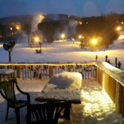
unconfirmed snow report....Friend in Davis claims a foot so far..
DCSki Sponsor: The Omni Homestead Resort

Ski and Tell

Speak truth to powder.

Join the conversation by logging in.

Don't have an account? Create one here.

0.15 seconds