Kevin Whipple has uncovered another lost ski area in Pennsylvania. Kevin submitted the following description of the Crystal Lake Ski Center:
This area is near Williamsport, PA on the Lycoming and Sullivan county border in north-central PA, just north of Mapleton Church.
I spoke with Dottie Alford, the administrator of the current Crystal Lake Ski Center which remains a popular cross-country ski area and mountain retreat. She was enthusiastic and very helpful and gave me the following information about the former downhill skiing operation at Crystal Lake.
The ski area operated from 1971-1996. It had one poma lift that came from the defunct Highland Ski Area nearby, and one rope tow serving a beginner slope. The area had night skiing, snowmaking, and a Thikhold groomer. A summit elevation of 2100’ and a base of 2000’, giving the area 100’ of vertical (although I think this was inaccurate and was more like 200’-250’ of vertical). Originally, the downhill area was going to be the heart of the winter operations at Crystal Lake, but expenses and staffing would end it. The area was forced to rent equipment to keep up with new technologies.
Today, Crystal Lake Ski Center is a beautiful nordic skiing area on 960 acres of mountain woodlands, lakes, ponds, and creeks. It boasts winterized dining facilities, lodging for 180 guests in winter, conference rooms, and recreation facilities. The nordic area features grooming on 30 km of trails and rental skis and snowshoes.
Visiting the area, the trails have not grown in much at all. The poma lift is still in place, as well as the rope tow (minus the rope and drive). The small base lodge and rental building are still standing at the base. I’m unsure, but the area seemed to offer two broad slopes on skier’s left of the poma, and one wide trail and one narrow wrap-around trail on skier’s right of the poma. The learning slope was at the base and descended to a point below the base lodge. The terrain had a nice headwall midway down the mountain which made for some interesting skiing. Although the area is located in a gorgeous mountain area with some worthwhile terrain, it is located in a desolate location (not easy to get to at all) and lacked size and facilities to compete.
In March, 2009, Ezra Burgess wrote to DCSki with the following information:
“I was particularly interested in your report on the lost ski areas in Lycoming and Sullivan Counties. I am the founder of the ski patrol at Crystal Lake Ski Area in 1986 and, at the time, we had the distinction of being the only Nordic Patrol in the Eastern Division NSP that also patrolled an alpine slope. One thing that was not mentioned about the downhill area was that the slope to the far left was one of the first tubing slopes in Pennsylvania. I don’t remember the exact year they opened it, but if you contact the center I am sure they could tell you.
It might also interest you to know that one of the primary reasons the alpine ski operation had to close was the oppressive liability insurance premium that was needed to operate. I am sure this is the reason many of the other smaller areas were forced to close. Our increasing litigious society seems to have no idea how much is being lost as a result of more and more expensive lawsuits which have driven up liability premiums to the point where small businesses can no longer continue to operate.”
|
|
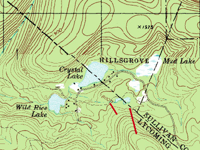
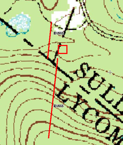
Topographic map of the area, with an estimated location of the ski lifts. The base facilities were right at the base of the poma lift (the longer red line reaching the summit). Image provided by Kevin Whipple.
|
|
|
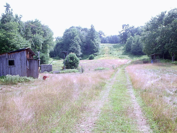
Looking up from the general area of the parking lot. Base buildings are located to the right with the base terminal of the poma just left of this. To the far right of this photo is the top terminal of the beginner tow, but it is hard to distinguish here. Photo provided by Kevin Whipple.
|

|
|
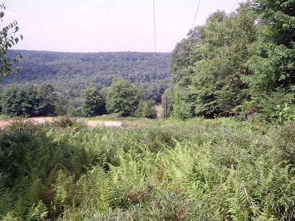
Looking up the poma line. Kevin says the whole lift is still in pretty good shape. “The headwall to the right of the lift line was the steepest part of the hill. There was an intermediate round-about slope to the right of this. Both of these routes emerged from a vast upper mountain meadow.” Photo provided by Kevin Whipple.
|
|
|
Looking down the poma line from near the unloading point. “To the left was a large meadow that filtered into a blue slope and an advanced slopes, as seen in previous photos,” writes Kevin. Photo provided by Kevin Whipple.
|
|
|
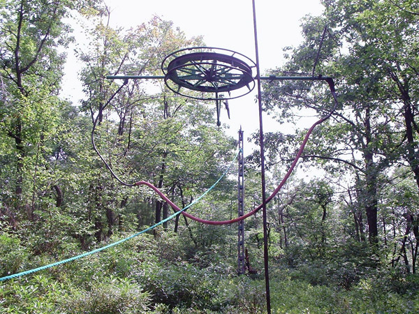
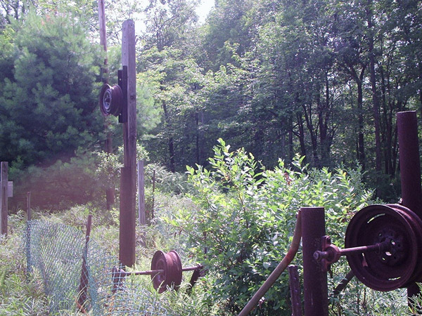
The summit bullwheel of the poma lift. “The ‘floating’ bullwheel design (not anchored, but suspended from cables) is something I have not seen in my travels before, although I know they are out there,” writes Kevin. Photo provided by Kevin Whipple.
|
|
|
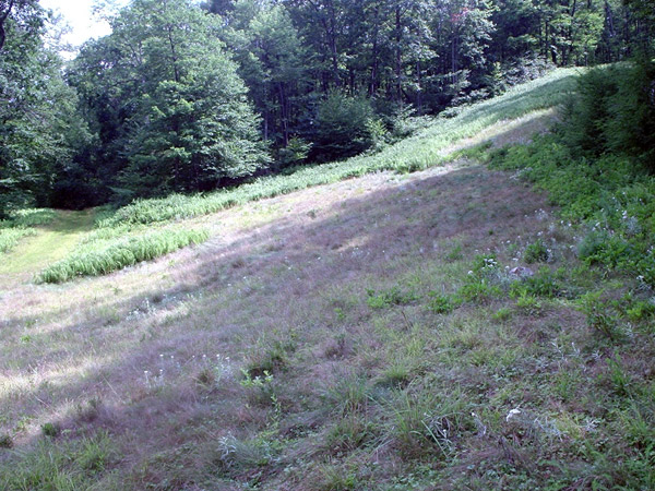
Base of the trails on skier’s right of the poma lift. “The slope seen here ran top to bottom and had a real nice pitch (possibly advanced),” Kevin writes. “On this trail, like the others, there is very little regrowth. There is an opening in the treeline across the slope which is the point where the narrower round-about trail came out. That trail would not have been more than two groomer widths wide, I would guess.” Photo provided by Kevin Whipple.
|
|
|
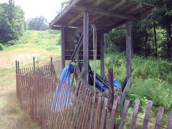
The remains of the base terminal for the beginner rope tow, at the lowest elevation for the ski area. Photo provided by Kevin Whipple.
|
|
|
The top terminal of the beginner rope tow. Photo provided by Kevin Whipple.
|
|
|
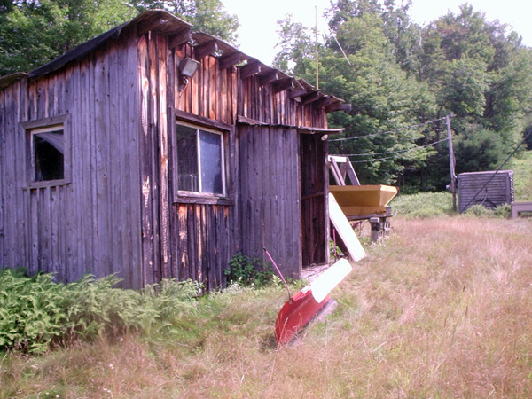
The rental building. Kevin writes that the rental building appeared more like a shack. “It would have had some character, if the base lodge (not shown) wasn’t a bland, modular building.” Photo provided by Kevin Whipple.
|
Kevin Whipple provided the following images in September, 2008:
|
|
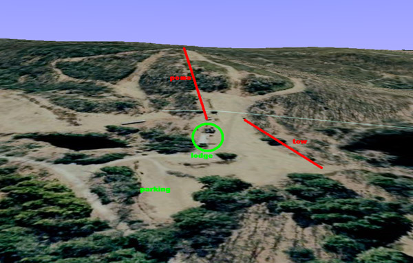
A 3-d view from Google Earth showing the lift layout and facilities. Image provided by Kevin Whipple.
|
|
|
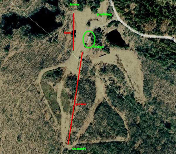
An aerial image from Google Earth with lifts and lodge labeled. Image provided by Kevin Whipple.
|
|
|
An updated topographic map for the area with lifts and facilities labeled. Image provided by Kevin Whipple.
|

Join the conversation by logging in.
Don't have an account? Create one here.
