
Kevin Whipple writes about a lost ski area in Pike County, Pennsylvania:
“Another lost ski resort is Tamiment Resort in the Poconos of Pike County, off Bushkill Falls Rd. very near to the popular Bushkill Falls. Tamiment was founded in 1921 as a luxury hotel/conference center and community encompassing 2,200 acres of woodlands, hills, streams, and ponds. The resort was once owned by Wayne Newton (probably in the Pocono resort hey-day when gambling was to be legalized here). It was a full-service resort with a vast amount of amenities which included a beautiful, Robert Trent Jones Jr. designed championship golf course. Some golf holes doubled as ski slopes in the winter.
The Tamiment Resort closed its doors in 2003, and I’m unsure of the current plans for the property. I think the golf course is still open for play, but I could be wrong.
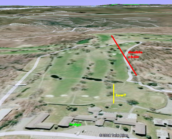
There was one chairlift, and possibly a surface lift, for downhill skiing in the winter. The area had maybe 200 feet of vertical drop. The loading area for the chairlift is down a slope that descended from the ski lodge. There had to be some sort of surface lift to bring guests back up to the lodge, or else it is clear to see why this skiing operation did not survive. The hill going back up to the lodge from the base of the slopes had nearly 100 feet of vertical drop and was about 200 yards away, which would have made for a strenuous walk back.
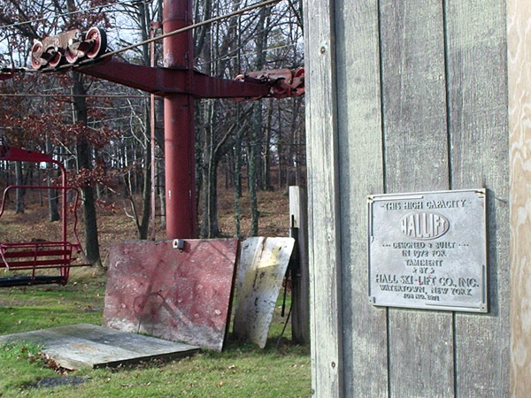
The grade of the ski slopes was beginner, with no real challenges anywhere. The chairlift was a double made by Hall. A plaque at the base of the lift says it was installed in 1972. To me, this was a poor move by the resort as there are a couple of hills on the property that would have been better suited. Plus, the chairlift runs right through a few golf holes which makes for an eye-sore during the golf months (and still does despite the ski operation shutting down). I’m sure they put it there to utilize existing facilities like the ski lodge, parking, lack of tree removal, and water lines for snowmaking (summer irrigation).
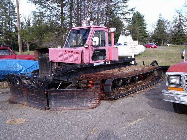
There was a semi-modern groomer still parked there when I visited. It looked like a wonderful place to learn the sport of skiing, but not one to progress yourself to new levels. The distance from lodge to lift would certainly have been an issue unless there was a surface lift (which I couldn’t find remnants of).”
Kevin provides the following photos.
|
|
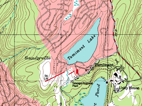
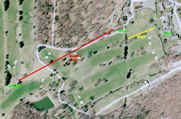
A topographic map of the area with approximate lift layout. The double chair is the longer red line, with the shorter line being where there might have been a surface lift. The red box on this map is the location of the ski lodge. Image provided by Kevin Whipple.
|
|
|
The plaque at the base of the chairlift, indicating that the lift was designed by Hall and installed in 1972. Photo provided by Kevin Whipple.
|
|
|
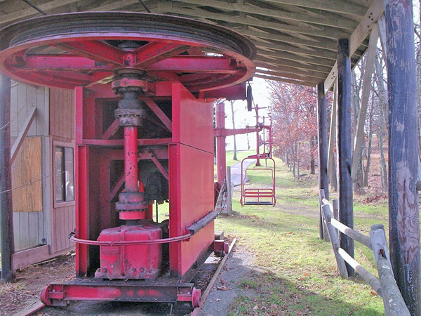
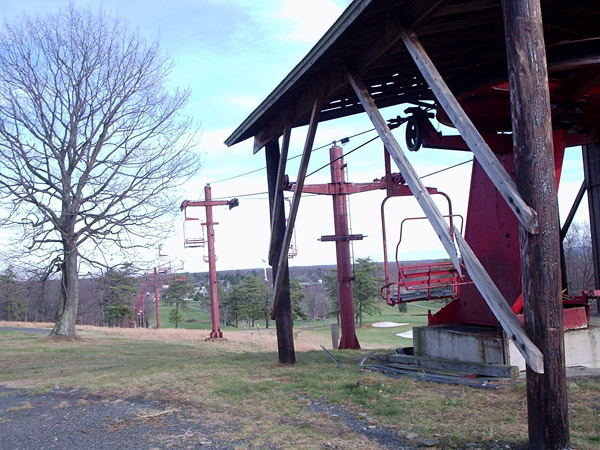
The base of the double, looking up the lift line. This shows some of the classic Hall chairlift features like the bullwheel and drive mounted on rails (like a railcar), and the separate cross arms on the lift towers fastened together making a lower case “t” as opposed to the far more common (and safer) single cross arm forming a capital “T.” Photo provided by Kevin Whipple.
|
|
|
The grooming machine located in the parking lot during Kevin Whipple’s visit. Photo provided by Kevin Whipple.
|
|
|
Near the summit of the double. “Essentially, the lift serves just one easy meadow that is dotted with some trees,” Kevin writes. “Golf holes were used as the winter slopes.” Photo provided by Kevin Whipple.
|
In April, 2009, Kevin Whipple provided the following additional images:
|
|
A 3-d view of the hill from Google Earth. “There was a creek running near the base of the double,” Kevin says. “It was a nice downhill slope from the lodge to the lift (uphill return).” Image provided by Kevin Whipple.
|
|
|
An aerial image of the hill from Google Earth. Image provided by Kevin Whipple.
|
|
|
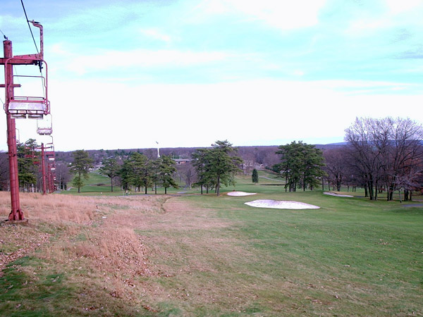
Looking down the main slope from near the top of the double chair. Photo provided by Kevin Whipple.
|
|
|
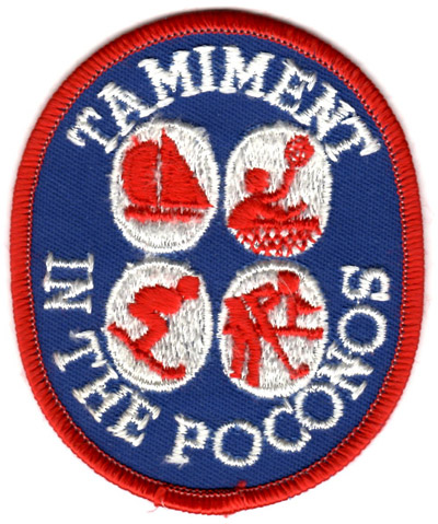
Ski patch for Tamiment. Photo provided by Woody Bousquet.
|



Reader Comments