Bill O’Hara provides the following ad from Wolf Hollow Ski Area from an old ski atlas, courtesy of www.teachski.com. The ad was published in 1969. DCSki does not currently know when Wolf Hollow closed down.
|
|
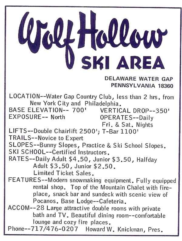
An ad published in a 1969 ski atlas. Photo courtesy of www.teachski.com.
|
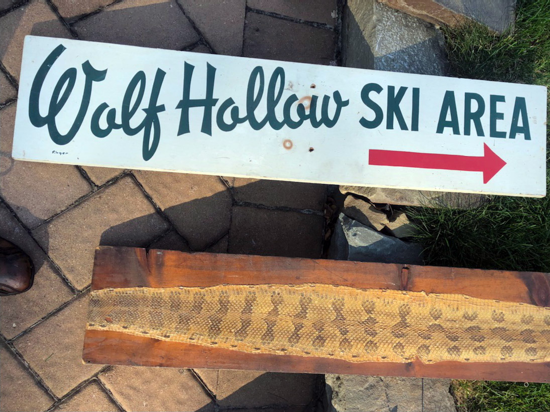
James Josephs provides the following photo of a Wolf Hollow sign. “We found the sign in the road after our family skied there about 50 years ago,” James writes. “We kept the sign in our family as a remembrance.”
Kevin Whipple provides the following additional information about Wolf Hollow Ski Area:
“It’s located right off Route 611 in Delaware Water Gap - on the golf course for the Delaware Water Gap Country Club. There is an old access road that is now gated and closed to vehicles that makes for a nice access point to hike the old ski area. Turn at the DeerHead Inn in Water Gap on Route 611 towards the PA access lot to the Appalachian Trail. Follow this road all the way up until you reach the entrance sign for the Delaware Water Gap Country Club Golf Course. At this sign is a small parking area with two gated roads leading from it. Park here and take the road on the right. When you notice some clearings in the woods to the right, take to the woods and eventually you should run into the remnants of the old ski hill.
I really don’t know anything about this lost area (trails, lifts, facilities, opening date, closing date, etc.) I live in the Water Gap and never knew the Country Club had a ski hill. The ski slopes seem to have been abandoned for some time now, as the overgrowth is very thick and lift lines are full of semi-mature trees. If I had to pose a guess, I’d say the skiing here did not make it into the 1980’s (of coarse, I could be wrong).
From what I can gather on my visit in 2007, the current golf clubhouse must have served as the lodge. It is located at mid-mountain, right wherethe trailsbreak through the trees onto the open meadows of the golf coarse. The lifts (a double chair and t-bar) look like they extended down from the treeline to a point down the hill on the golf course. Interestingly, only the portions of the lifts that extended below the trees and out on the golf course were removed. The remnants in the woods still stand.The double chairwas just cut in half. It is a complete lift(minus the chairs) from the woods line to the summit. Below the woods there is nothing left. The haul rope was even cut in half, and is draped between the lifttowers (still on the sheave wheels). I can’t say I have ever seen this before.
You can still see lightsand snowmaking lines in the woods thatwere once along trails, but the trails are hardlyidentifiable with the regrowth. The top and bottom of the hill was ofvery easy grade with one very steep headwall in the center. The t-bar ran right to the base of this headwall, serving the lower mountain meadow. The double ran base to summit. This was a very interesting hike and looked like a fun place to ski. I wish I knew more about this place.”
Kevin provides the following photos from his visit:
|
|
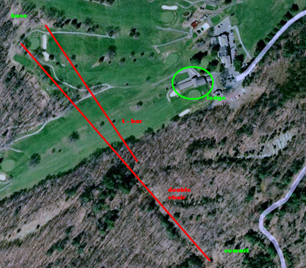
This image shows Kevin’s best guess at the probable lift layout. “The longer red line would be the double chair, and the red box is the current clubhouse location, and possibly ski lodge as well,” Kevin writes. Image provided by Kevin Whipple.
|
|
|
This photo shows the only remnants Kevin can find remaining on the golf course. “It’s a tower footer for the double in the foreground, with the clubhouse in the distance,” he notes. Photo provided by Kevin Whipple.
|
|
|
The remnants of the top terminal of the t-bar, right inside the treeline from the golf course. Photo provided by Kevin Whipple.
|
|
|
One of the double chair towers. “Note the height of the tree growth around the tower, and the haul rope still draping on the sheave assemblings,” Kevin writes. Photo provided by Kevin Whipple.
|
|
|
Another double chair tower and the untensioned haul rope draped from the ground to the sheaves. Photo provided by Kevin Whipple.
|
|
|
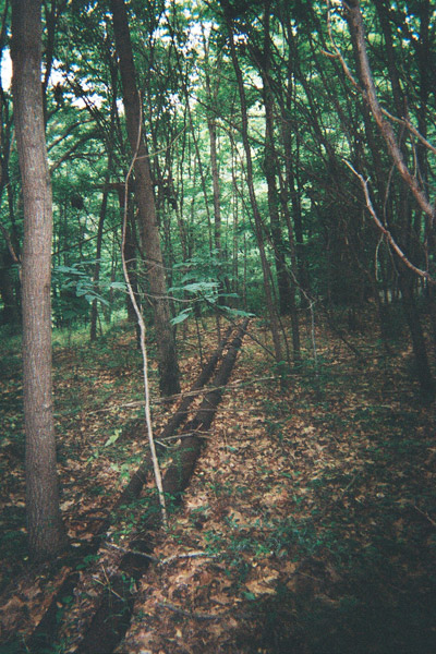
Snowmaking lines running down the hill along the double chair liftline. Photo provided by Kevin Whipple.
|

|
|
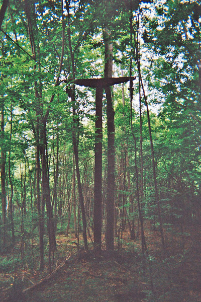
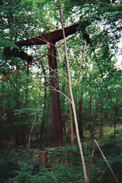
The top terminal of the double, which was mostly encased in vines during Kevin’s visit. Photo provided by Kevin Whipple.
|
|
|
A closer shot of the top drive motor. Photo provided by Kevin Whipple.
|
In April, 2009, Kevin Whipple provided the following additional images.
|
|
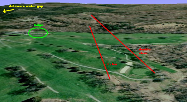
A 3-d view of the hill from Google Earth. Image provided by Kevin Whipple.
|
|
|
An aerial image of the hill from Google Earth. Image provided by Kevin Whipple.
|
|
|
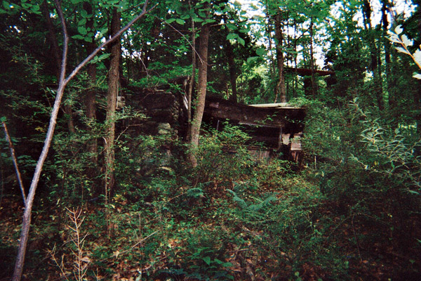
A deteriorating shack just above the summit of the t-bar. Notice the double tower just beyond it to the right. Photo provided by Kevin Whipple.
|
|
|
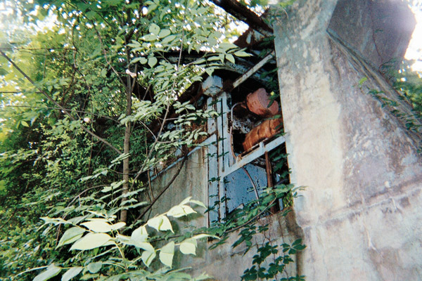
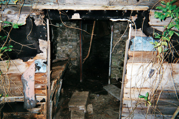
The interior of the deteriorating shack. Photo provided by Kevin Whipple.
|
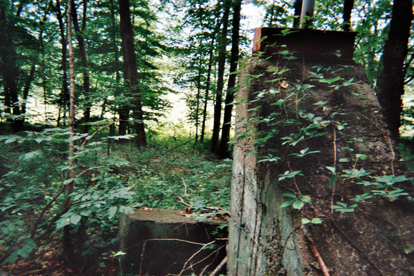
Visited this area recently. Sadly I can't offer much more info. Was opened probably in the late 60s when the lifts were installed around 1967. Both lifts were manufactured by Borvig. The double chair had about 300 feet of vertical, and the t-bar ended about halfway up. The area was bisected halfway up by a steep pitch, right in the woods above the golf course. There looks like there was a main slope straight down adjacent to the double chair, and an easier out and back trail in the woods skiers left from the top of the double. Interestingly, the double chair may have been in a configuration with the drive at the top. There is an extant stone structure about three quarters of the way up the double lift line, but I'm unsure what this housed. The brochure mentioned a "mountain chalet" but I'm not sure if this was a seperate building on the ski area grounds or not.
It doesn't seem to have lasted very long, likely closing in the late 70s based on aerial photography and the amount of overgrowth on the site today. The lift towers and slack haul rope look the same as in Kevin's photos, but the small stone building has since collapsed.

Join the conversation by logging in.
Don't have an account? Create one here.
