Kevin Whipple describes a lost ski area in Pennsylvania formerly located near the Pocono Lake Preserve Community:
“Another lost Pennsylvania ski resort can be found at the Pocono Lake Preserve in Monroe County. The slope is located off Stoney Brook Road from Route 940 in Pocono Pines, PA (between Mount Pocono and Blakeslee on 940).
The area is currently located on State Game Lands, but may have once been a part of the exclusive Pocono Lake Preserve Community.
I do not believe that this hill was ever open to the public. If it was, then I can’t believe it was very popular. It seems no one I’ve talked to can remember there ever being a ski slope here. I found out about it from local hunters who stumbled across it in their travels. It was likely a private hill for use by community members, which is still common all over the Poconos.
In the event that this area was a part of Pocono Lake Preserve Community, then the proposition of some very influential people using this facility is probable. The Pocono Lake Preserve Community has historically been very, very exclusive. Armed guards at the gates sort of stuff. I’m not sure it remains this way today. Many industry tycoons, US presidents, and Hollywood elite have had homes within this community.
The slopes do not appear on USGS topographic maps, but are very easy to see on older satellite images. The ski area appeared to have one surface lift and 2-3 trails. Upon my visit in 2005, I could not find any remnants of the former lift (a light snow cover may have hidden something). The towline is very easy to identify and remains quite clear. It runs right up the middle of the area, through the woods, and serves two primary slopes on either side of it. I would guess the vertical descent to be just over 100 feet, and the grade of the entire hill was very easy. Skier’s right of the towline was a vast meadow of beginner grade. I would guess this slope was about fifty yards wide, and remains fairly clear with some small evergreens popping up. Skier’s left of the towline was a far more narrow option that twisted its way through some tree islands to the base. If it was an intermediate option, then it would have been more due to narrowness and glading than to steepness. I have no idea if this was one trail or two that weaved together down the slope.
I could not find any evidence of snowmaking, or night skiing. That’s not to say there was none, and the light snow cover during my visit may have hidden something. I don’t know what kind of facilities it had as far as a lodge, or if it had any sort of grooming (I should hope so with the lack of steepness). There are some homes located adjacent to the slopes, and perhaps one of these served as a lodge at one time. I have no idea or evidence that this was the case.
I have very little information on this place. Judging by the growth on the trails, and how clear the area is on satellite pictures, this area probably saw action into the late 1980’s. That’s a guess.”
|
|
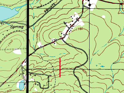
This topographic map shows the approximate lift location. The road directly to the northwest of the area is Stoney Brook Road. Image provided by Kevin Whipple.
|
|
|
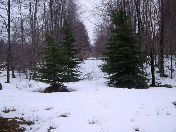
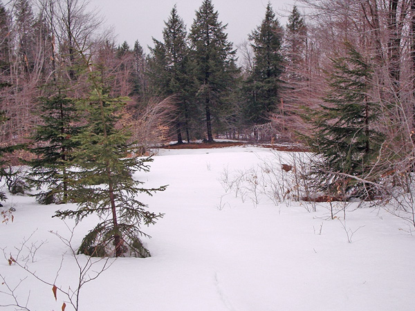
Looking up the towline from the base of the slopes. Photo provided by Kevin Whipple.
|
|
|
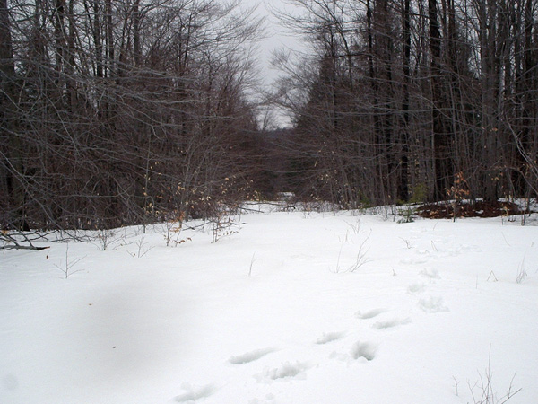
Looking down the towline from the summit of the slopes. Photo provided by Kevin Whipple.
|
|
|
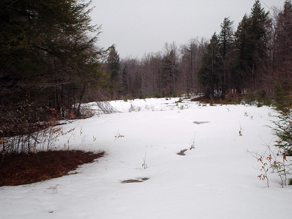
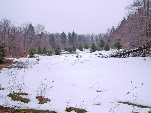
The entrance to the main meadow on skier’s right of the towline. Photo provided by Kevin Whipple.
|
|
|
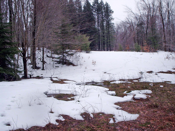
The base of the main slope, on skier’s right, from the bottom of the hill. Still fairly clear. Photo provided by Kevin Whipple.
|
|
|
The top of the trail on skier’s left of the towline. It’s more grown in, and had tree islands and gladed sections. Photo provided by Kevin Whipple.
|
|
|
The base of the narrow trail on skier’s left of the towline. Photo provided by Kevin Whipple.
|
|
|
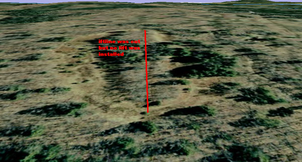
A 3-d image from Google Earth. Image provided by Kevin Whipple.
|

