
By the first week of January, the Mid-Atlantic ski season should be gathering momentum. The holiday crowds have departed, snowmaking crews have built a respectable base, and skiers begin settling into the familiar rhythm of weekend (or crowd-avoiding day trips) to the mountains.
That was not how January, 1998 unfolded.
On January 6, 1998, Pennsylvania’s Liberty Mountain suspended operations, waiting for colder weather. Nearby Whitetail curtailed its hours and canceled night skiing. Roundtop remained open, but visitors encountered spring-like conditions while rain approached. Less than a week later, all three ski areas were closed, trying to salvage what remained of their snow and watching the forecast for temperatures low enough to resume snowmaking.
The winter of 1997-1998 offers one of the clearest examples of how quickly a Mid-Atlantic ski season can unravel — and how the effects of a bad winter can linger long after the last patch of snow disappears.
The culprit was one of the strongest El Niño events on record. El Niño occurs when unusually warm water in the tropical Pacific alters atmospheric circulation, influencing weather patterns across much of the globe.
Its effects vary by location and from one event to another, but the 1997-1998 El Niño delivered precisely the combination Mid-Atlantic ski areas fear most: persistent warmth accompanied by frequent rain.
Nationally, December 1997 through February 1998 ranked as the second-warmest and seventh-wettest winter in the United States since recordkeeping began in 1895, according to a National Oceanic and Atmospheric Administration analysis.
The departures from normal were especially striking in the mountains of Pennsylvania, home to many Mid-Atlantic ski areas. The average temperature there during January 1998 was 31 degrees Fahrenheit — 8.5 degrees above normal. February averaged 32 degrees, or 7.3 degrees above normal, according to Pennsylvania climate statistics.
An average temperature near freezing might not sound disastrous. For a ski area, however, an average blends the useful cold hours with the warm afternoons and rainy stretches that consume snow faster than it can be replaced. Effective snowmaking generally requires a sufficiently low combination of temperature and humidity, preferably for long, uninterrupted periods. A brief overnight window may allow crews to coat a trail, but it might not provide enough time to build the deep base needed to withstand the next thaw.
During the winter of 1997-1998, those sustained windows were frustratingly scarce.
Liberty, Roundtop, and Whitetail opened on December 17, 1997, but the early terrain was limited. A spell of cold weather late in the month allowed snowmakers to make progress and briefly offered hope that the season was finally about to get underway.
Then temperatures climbed into the 50s during the first days of January.
By January 7, DCSki reported that Liberty had closed and Whitetail had scaled back its hours. Rain compounded the damage. Several nights of snowmaking would be needed before the resorts could repair their slopes, but Mother Nature was unwilling to cooperate.
Five days later, DCSki’s condition roundup found Liberty, Roundtop, and Whitetail all sidelined after the stretch of warm, rainy weather. Each was waiting for enough cold to rebuild.
That pattern repeated throughout the winter. Snowmakers would seize a cold interval, reopen terrain, and begin restoring the base. Warm air and rain would return before they could finish the job.
By late February, the struggle was visible in the trail counts. Liberty had seven trails open, Roundtop nine, and Whitetail seven. Whitetail’s tubing operation was closed as well. DCSki observed that heavy rain and warmth had crippled the ski areas closest to Washington, while the absence of prolonged cold prevented snowmaking crews from building the base depths they normally relied upon to survive a thaw.
Neither Liberty nor Whitetail managed to open all of its terrain during the season. Both suspended operations on March 1. Although conditions allowed some areas to squeeze out additional operating days later in March, the season had effectively run out of chances to recover. And, as we’ve seen time and time again in the Mid-Atlantic, once the calendar rolls around to March, many skiers simply hang up their skis, regardless of snow conditions.
The winter was not equally disastrous everywhere, though.
While ski areas near Washington and Baltimore struggled, West Virginia’s higher mountains experienced a very different season. Snowshoe Mountain accumulated more than 170 inches of natural snow by early March, had all 54 of its trails open, and ultimately approached 200 inches as it prepared to continue skiing into April. Seven Springs and Wisp also generally maintained more terrain than resorts farther east.
The contrast demonstrated how several versions of winter can exist simultaneously within the Mid-Atlantic.
A difference of several thousand feet in elevation can determine whether a storm falls as snow or rain. Mountains positioned along the Appalachian spine can intercept moisture and receive upslope snowfall while locations to the east remain warm and wet. A few degrees can separate a base-building snowstorm from a cold rain that strips a slope bare.
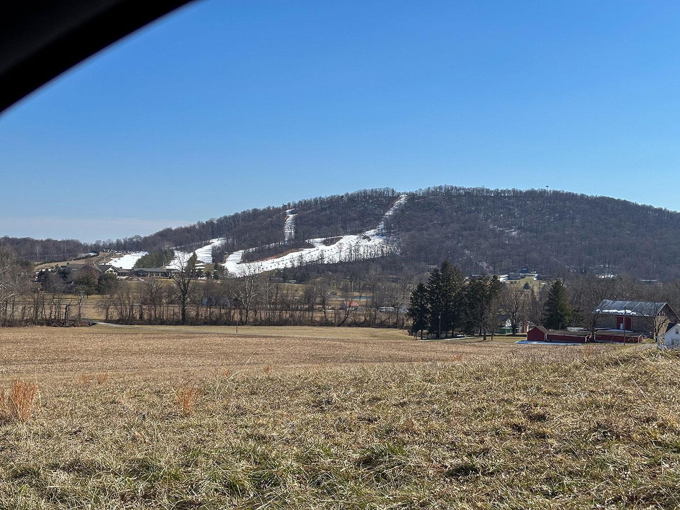
Those distinctions help explain why certain Mid-Atlantic ski areas have historically been more resilient than others. Higher elevations, favorable exposure, greater natural snowfall, and longer snowmaking windows provide protection. They do not eliminate weather risk, but they give a ski area operator more opportunities to recover.
For lower-elevation resorts near major population centers, the advantage is proximity to customers. The disadvantage is a climate that can turn hostile to skiing for weeks at a time.
Ski areas are unusual businesses because so much of their annual revenue must be generated during a narrow and immovable window.
A rainy Saturday in January cannot be rescheduled for June. Once that day passes, its potential lift-ticket sales are gone. So are many of the rentals, lessons, meals, and retail purchases that would have accompanied them.
The financial damage extends beyond the resort. Local ski shops lose equipment sales and tuning work. Lodging properties receive cancellations. Restaurants serve fewer traveling skiers. Seasonal workers lose hours. In communities where winter tourism supports a network of small businesses, a failed ski weekend ripples well beyond the slopes.
Operating expenses do not disappear at the same speed. Ski areas still have to maintain lifts, buildings, snowmaking systems, and insurance throughout the year, regardless of how much snow there was. Many employ full-time staff in every season. Electricity and labor used to produce snow have already been spent even if a warm rain washes that snow away several days later. This is why Mid-Atlantic resorts are very strategic in choosing when to make snow, balancing many factors — few of which they can directly control or predict.
A poor winter can therefore influence decisions well into the following summer. Maintenance may be deferred. Capital projects may be reduced or canceled. Hiring plans may change. Cash that might have funded a new lift or expanded snowmaking must instead cover the shortfall left by the previous season.
Modern season-pass programs such as the Epic and Ikon Pass can provide operators with revenue before winter begins, offering some protection from daily weather fluctuations. Diversified resorts may also earn money from lodging, conferences, golf, mountain biking, and other activities. Smaller ski areas built primarily around winter recreation have fewer cushions.
Whitetail provides a particularly vivid example of how consecutive mild winters can affect a ski area’s future.
The resort was still relatively young, having opened in 1991 with extensive snowmaking, modern lifts, and ambitious development plans. Its location close to Washington and Baltimore attracted a large potential audience, but constructing a major ski area required substantial investment. The business needed dependable winter revenue to service that burden.
Instead, Whitetail encountered two difficult seasons in succession. The winter of 1996-1997 had already been unusually mild. El Niño then arrived and overwhelmed much of the 1997-1998 season.
Those winters were not the only factors affecting the resort, and it would be too simple to blame Whitetail’s later financial difficulties on weather alone. Startup costs, debt, and development decisions all factored in. But consecutive winters with limited operations deprived the young resort of revenue at a particularly vulnerable time.
Whitetail enjoyed a better 1998-1999 season, yet one successful winter could not erase the accumulated pressure. Its owners sought a buyer, and after some drama, the resort ended up on the ledger of Snow Time, which owned one-time competitors Liberty and Roundtop at the time.
Whitetail survived and continued operating, and is now part of the portfolio of Vail Resorts. The episode nevertheless illustrates the consequences that weather can set in motion. A failed winter affects more than one season’s final trail count; it can change ownership, employment, investment, and the long-term direction of a resort.
Mid-Atlantic resorts have invested heavily in snowmaking since 1998. Today’s systems can cover terrain faster, use energy and water more efficiently, and respond more precisely as temperatures change. Automated equipment allows snowmakers to take advantage of short weather windows that might once have been lost.
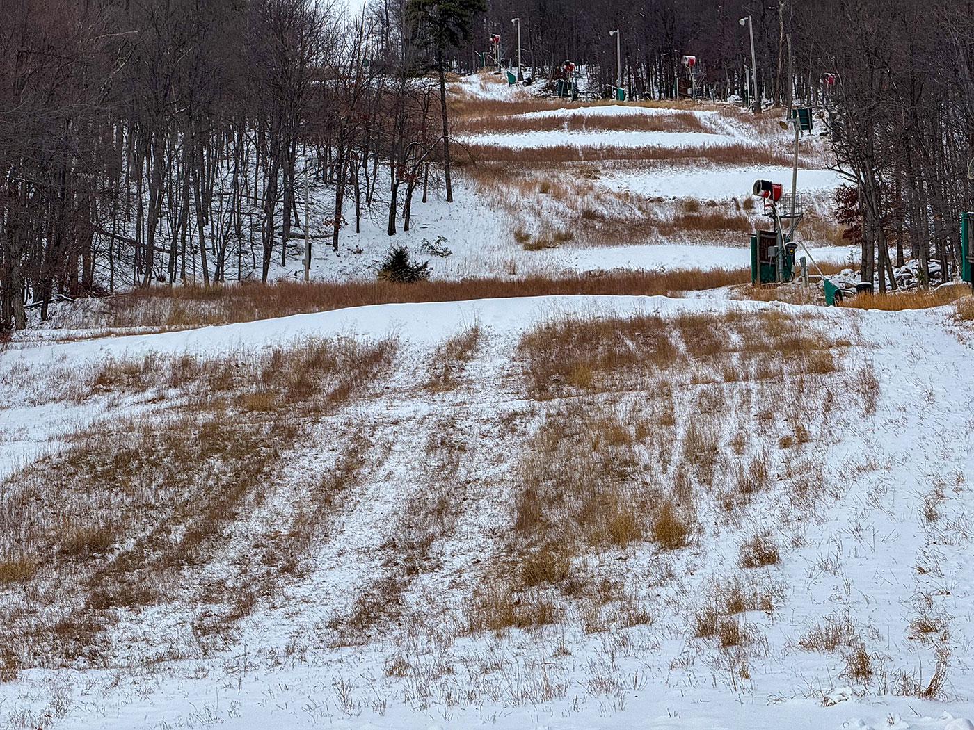
Those improvements have made local ski areas far more resilient. A modern resort can transform bare ground into a skiable slope after several nights of good snowmaking weather.
Yet the basic requirement remains unchanged: the air must be cold enough, preferably with low humidity and minimal wind blowing it around.
The winter of 1997-1998 denied resorts those magical conditions for much of the season.
Weather risk is hardly confined to the Mid-Atlantic.
During the most recent 2025-2026 season, Colorado experienced a winter that challenged assumptions about the reliability of high-elevation western skiing. The state entered 2026 after its second-warmest October and November since 1895. On January 1, statewide snow-water equivalent stood at just 56 percent of the median, and 38 percent of Colorado monitoring sites with at least 20 years of observations reported record-low snowpack, according to the USDA Natural Resources Conservation Service.
Warm temperatures meant that some early-season precipitation fell as rain instead of snow. The snowpack peaked unusually early and then melted rapidly. By April 9, Colorado’s statewide snowpack had fallen to 22 percent of the median.
Vail Resorts, which operates several major Colorado ski areas as well as many Pennsylvania areas, described the season as the most challenging Rockies winter the company had experienced. Its Colorado and Utah resorts recorded their lowest snowfall in more than 30 years, while warmth and limited terrain weakened visitation. The company subsequently reported lower resort earnings than in the previous year and attributed much of the decline to one of the worst western snowfall seasons in decades.
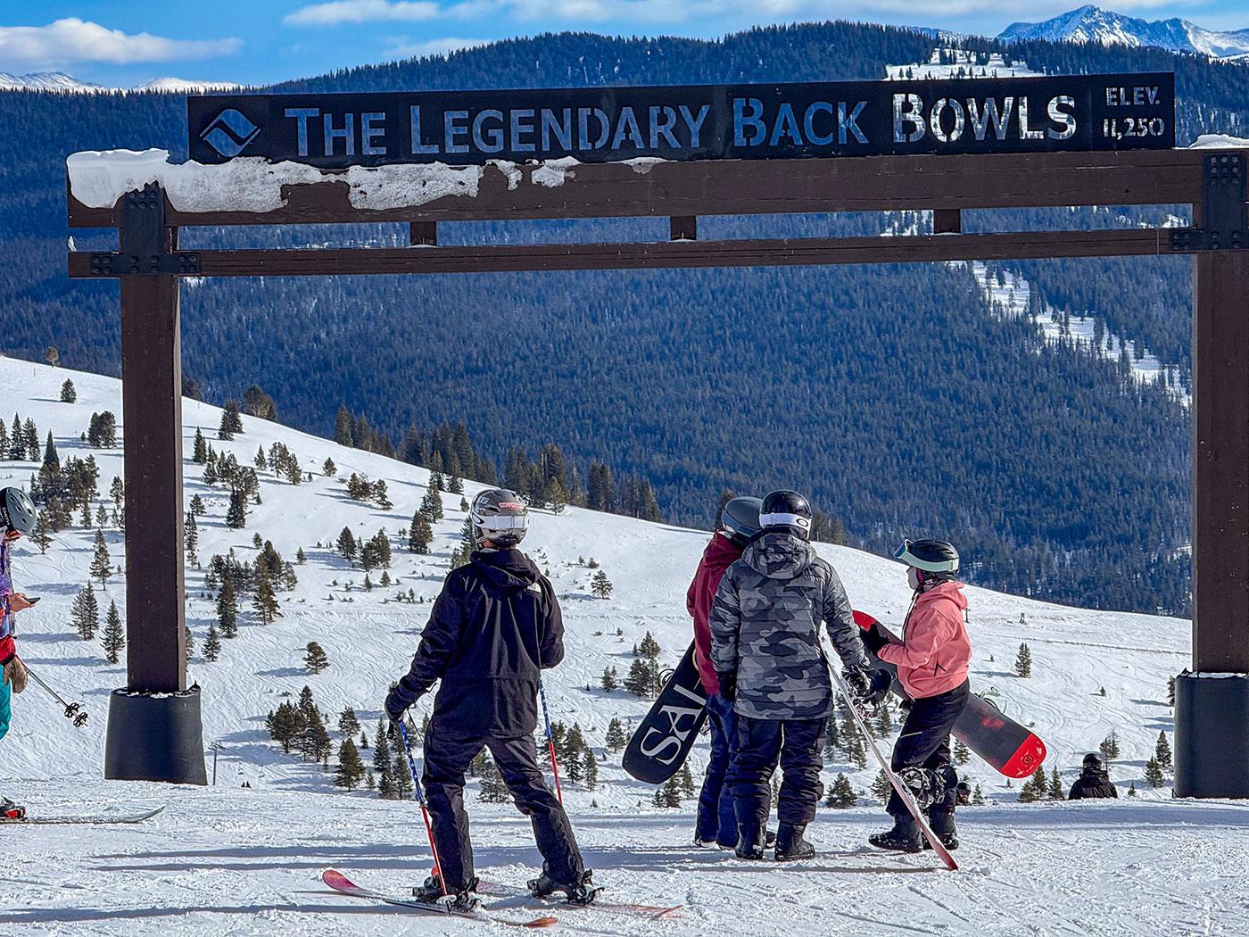
Colorado resorts possess advantages that most Mid-Atlantic ski areas do not. They generally operate at higher elevations, have longer seasons, draw destination travelers, and often combine skiing with extensive lodging, dining, and year-round recreation.
Even with those buffers, an exceptionally warm and dry winter was felt throughout the industry. The experience was a reminder that elevation and geography can reduce weather exposure without eliminating it.
For a Mid-Atlantic area whose core season may be compressed into approximately three months, the margin for error is narrower still. Losing several prime weekends is damaging. Losing much of January or February can threaten the economics of the entire year.
Looking back through DCSki’s reports from 1997-1998, the most striking feature is the repeated return of hope.
A cold front would appear in the forecast. Snowmakers would prepare to run. A reopening date would be proposed. Then warmth or rain would intrude once again.
The reports capture a season disappearing incrementally — one missed night of snowmaking, one closed weekend, and one rainstorm at a time.
Ski areas have become better equipped since then. Their snowmaking systems are stronger, forecasts are more precise, and many operators have diversified their businesses. The underlying wager remains, though.
Weeks or months before winter begins, local resorts hire employees, inspect lifts, service snow guns, order supplies, and prepare their slopes. Ski shops purchase inventory. Instructors reserve their weekends. Lodging properties accept winter bookings. Each commits money and labor to a season whose length and quality cannot be known in advance.
Most years provide enough cold to make the gamble work. Some deliver deep snow and long seasons that become part of local skiing lore. Others, such as 1997-1998, reveal just how little separates a successful winter from one that barely arrives.
In the Mid-Atlantic, a ski area does not merely operate during winter. It wagers much of its year on winter arriving on time.
The 1997-1998 winter has renewed relevance as another powerful El Niño takes shape ahead of the 2026-2027 ski season.
As of July 2026, El Niño conditions are already present in the tropical Pacific. NOAA’s Climate Prediction Center expected the event to strengthen through the rest of the year, assigning a 97-percent probability that El Niño would persist into early spring 2027. Forecasters also placed the probability of a very strong El Niño during October through December at 81 percent, according to NOAA’s July 2026 seasonal outlook.
That forecast will understandably attract the attention of Mid-Atlantic skiers and resort operators.
Yet El Niño does not provide a simple forecast for the Mid-Atlantic. It describes conditions thousands of miles away in the tropical Pacific and their broad influence on atmospheric circulation. It cannot tell us whether it will be 30 or 35 degrees at Whitetail when a particular storm arrives in January.
El Niño commonly strengthens the subtropical jet stream, providing East Coast storms with an ample supply of moisture. NOAA’s current outlook expects the nation’s winter precipitation pattern to become increasingly characteristic of El Niño, with wetter conditions favored across much of the southern tier and parts of the Southeast. Whether that moisture helps or hurts Mid-Atlantic ski areas will depend largely on the temperature of the air it encounters.
For local skiers, the difference between an extraordinary winter and a miserable one can be measured in a few degrees.
If cold air is firmly established when a moisture-rich storm approaches, the result can be a major snowfall. If the storm tracks slightly farther west, or if warm air pushes north ahead of it, the same system can deliver sleet, freezing rain, or a cold downpour. The boundary between heavy snow and rain can shift across the Mid-Atlantic during a single storm, placing one ski area beneath accumulating snow while another, sometimes less than 100 miles away, watches its base wash downhill.
The National Weather Service’s Baltimore-Washington office has found that El Niño winters have averaged near-normal temperatures and precipitation locally, with above-normal seasonal snowfall. Strong El Niño events have tended to be warmer and wetter, however, and their snowfall results have varied dramatically. Of seven strong El Niño winters in the agency’s historical analysis, four produced well-above-normal snowfall in Washington and Baltimore, while three produced almost none. As the National Weather Service analysis makes clear, the presence and strength of El Niño alone cannot determine which outcome will occur.
DCSki’s archives contain their own reminders that El Niño is not automatically bad news. The 2002-2003 El Niño winter began with an early surge of cold and snow. By February, DCSki was describing it as a banner season headed for the history books, with consistent cold, abundant natural snow, and many resorts operating all of their terrain. Conditions had been favorable since late November.
The moderate El Niño winter of 2009-2010 supplied an even more dramatic counterexample. A series of storms buried the region, producing record seasonal snowfall around Washington and Baltimore and exceptional conditions at Mid-Atlantic ski areas. DCSki Columnist Jim Kenney described a powder-filled February day at Blue Knob as one of his best local ski days in 43 seasons. Whitetail subsequently called 2009-2010 a banner winter and invested $4 million in new terrain, snowmaking, grooming equipment, and other improvements.
That season benefited from more than El Niño. A strongly negative North Atlantic Oscillation helped channel and retain cold air in the eastern United States while El Niño contributed moisture and an active storm track. The combination produced 56.1 inches of snow in Washington, according to a National Weather Service review of El Niño, the North Atlantic Oscillation, and local snowfall.
Those other atmospheric patterns are among the great uncertainties in a seasonal forecast. The North Atlantic Oscillation, Arctic Oscillation, position of the polar jet stream, availability of Canadian cold air, and exact paths of individual storms will all help determine how the coming winter unfolds. Some of those ingredients cannot be predicted reliably months in advance.
A very strong El Niño may increase the odds of an active, moisture-laden storm track. It may also increase the risk that warm air accompanies those storms. The result could resemble 1997-1998, with one rainstorm following another. It could produce several blockbuster snowfalls separated by mild periods. Higher-elevation resorts might receive snow while lower mountains receive rain. A handful of well-timed cold stretches could allow snowmaking crews to build durable bases even if natural snowfall is limited.
In other words, the 2026-2027 El Niño forecast offers plenty to contemplate but little certainty. For Mid-Atlantic snowsports, the decisive question remains the one that has always mattered most: when the moisture arrives, which side of the rain-snow line will the mountains be on?
M. Scott Smith is the founder and Editor of DCSki. Scott loves outdoor activities such as camping, hiking, kayaking, skiing, and mountain biking. He is an avid photographer and writer.
That was a cool article Scott. It really strengthens your arguments that you can cite distant past reports from DCSki to confirm conclusions about good or bad snow years. (2010 was indeed a great local ski season!)
There are a group of folks that annually conduct a discussion on Snowjournal.com about how the current winter in New England compares to winters/ski seasons of the past. They've been doing it for more than a decade. Here is the 2026 discussion, and by the way, it ranked as one of the better ski seasons in New England in recent memory: discussion.
Those Snowjournalers are a bunch of old timers and have some great perspective, but some of it is quite anecdotal and possibly subject to memory lapses. Your article feels a bit more methodical/scientific :-)